|
Over the past 20 years, the MAPNet profiling facilities have participated in over 13 field campaigns focusing on both boundary layer (BL) and precipitation processes. In addition, the facilities have participated in over a dozen landfalling tropical cyclones and other local severe weather deployments. Most recently, the MAPNet facilities have played a large role in VORTEX-SE and providing BL profiling instruments for Hurricane Laura (2020) and Hurricane Ida (2021).
Although not complete by no means, the list below provides potential areas of research interest:
- An area of active interest is BL spatial transitions associated with surface heterogeneities, as summarized by Angevine et al. (2020). We have an interest in coastal transitions associated with landfalling TCs, and heterogeneities associated with variations in surface roughness that paint the landscape of northern Alabama.
- Temporal transitions in the BL, including the morning and evening transitions, show continued interest (Mahrt 2017, Blumberg et al. 2019, Kang 2020). Another type of temporal transition, termed the rain-induced transition (RIT, Knupp et al. 2019) is produced by rain evaporation from weak showers and stratiform precipitation ahead of cool season QLCSs.
- Fog forecasting and its connection to NBL structure and processes could benefit from lidar, sodar, Ka-band radars, and 915 MHz RWPs. Other opportunities appear to exist for air quality and boundary layer studies within the urban setting. We will note here that the MAPNet would also be ideally suited for fair weather and stable BL investigations.
- Mesoscale processes associated with quasi-linear convective systems, such as gravity waves, along with measurements that define the kinematic (updrafts, downdrafts), microphysical, and associated thermodynamic processes (cold pools) within QLCSs represent topics of continued interest and would provide potentially new insights on rapid tornadogenesis within QLCSs.
- Recent studies in cloud electrification and lightning associated with weakly electrified, low flash rate and non-convective clouds such as anvils, stratiform precipitation, thundersnow, and winter cyclones have raised interesting science questions regarding the dominant charging mechanisms in these clouds, their associated kinematic and microphysical processes and similarities and differences with deep convective thunderstorms (e.g., Dye and Willett 2007, Dye et al. 2007, Rauber et al. 2014, Kumjian and Deierling 2015, and Dye and Bansemer 2019). The multi-frequency measurements of vertical particle motions and high-resolution cloud morphology afforded by MAPNet would complement and extend current community capabilities associated with mobile scanning polarimetric/Doppler radars to study these novel cloud electrification processes (e.g., Rauber et al. 2014 during PlOWS).
|
Areas of Research:
- Air Quality
- Boundary Layer & Mesoscale Processes
- Biological Flyers
- Fire Weather
- Precipitation Processes
Recent Research Activities:
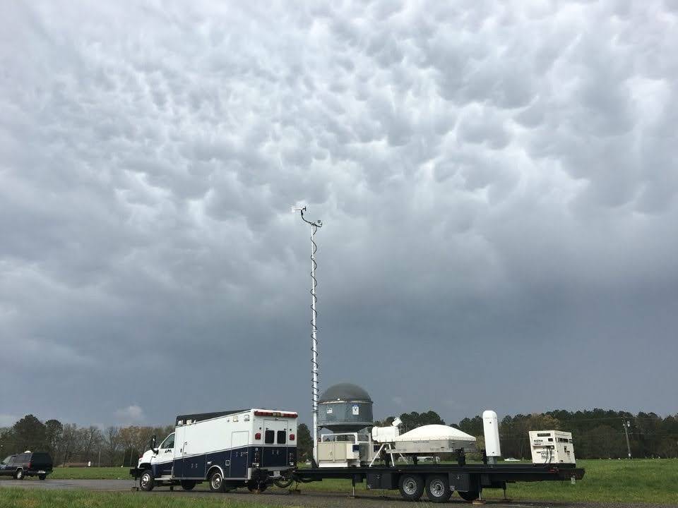
The MIPS platform deployed undearneath mammatus clouds.
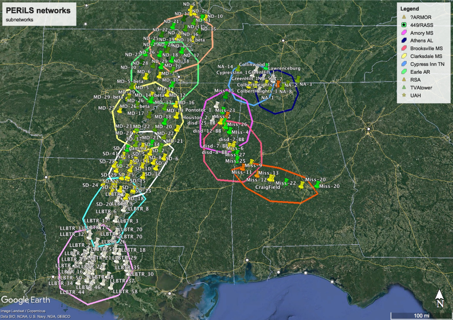
The PERiLS campaign that will take place in the Spring of 2022 with a goal to address QLCS tornadoes. The figure above shows the many possible experimental networks that will be used and how the MAPNet facilities will collaborate with many other institutions to help achieve this research goal.
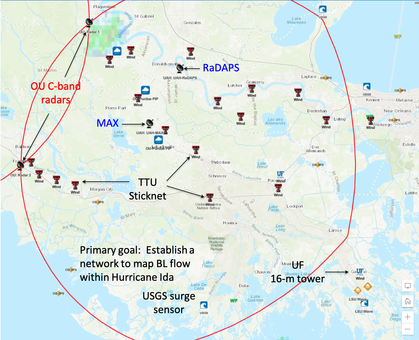
A dense, multi-institution network designed to map BL flow within Hurricane Ida (2021). This network provides an example of the MAPNet capabilities and how the facilities can be paired with additional facilities outside of UAH.
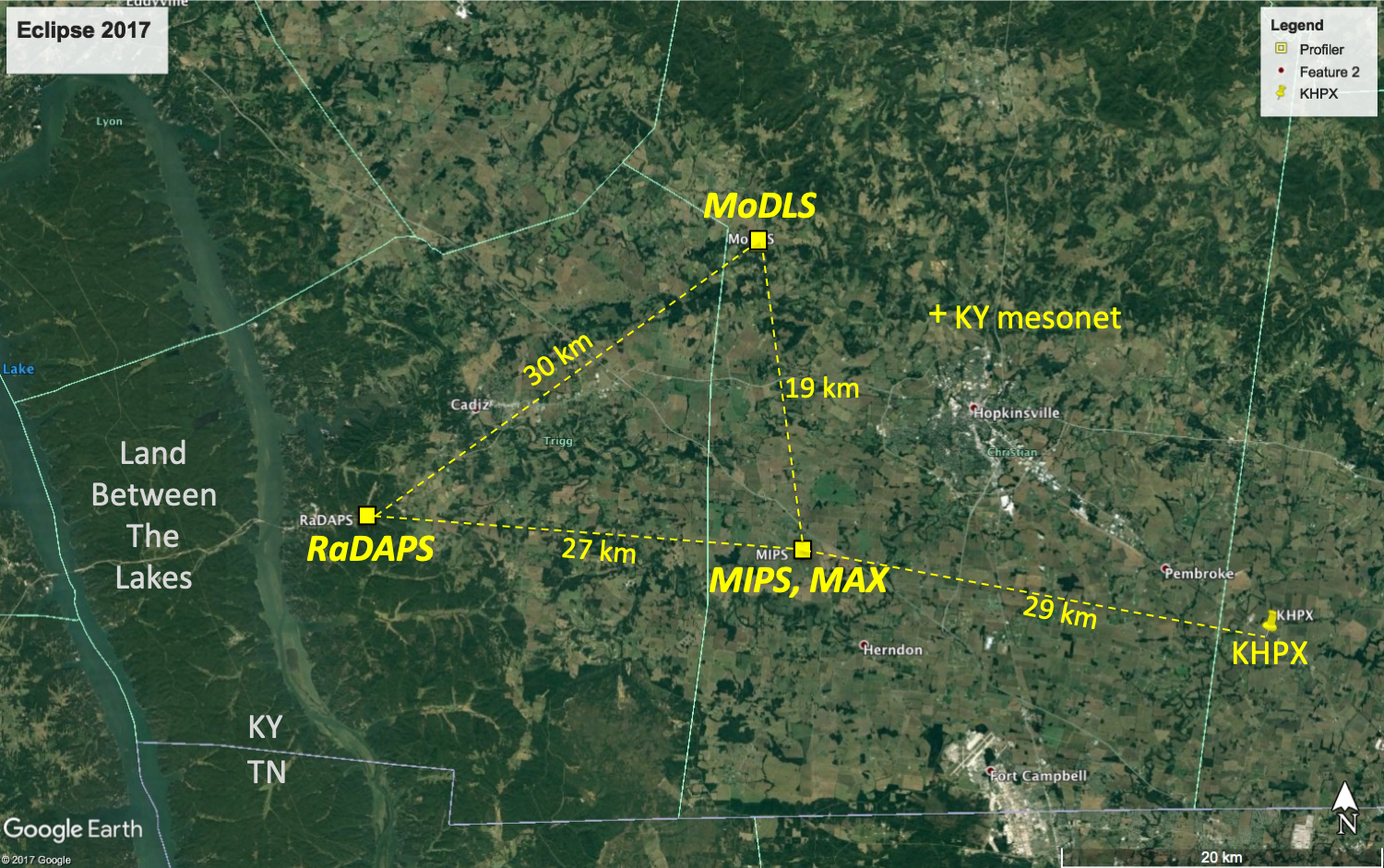
The network above was used for the MAPNet platforms when deployed to KY and TN for the 2017 Solar Eclipse. The goal of MAPNet was to document the boundary layer evolution during a solar eclipse. The most notable result was the rapid dissipation of turbulence during the eclipse that resembled the afternoon-to-evening tranisiton.
|
