MAPNet facilities includes a diverse set of instruments that are designed to measure high temporal winds, thermodynamics, cloudbase/aerosol, and precipitation profiles within the boundary layer (BL) to middle troposphere in all weather conditions. MAPNet is funded through the NSF Facilities for Atmospheric Research and Education (FARE) Community Instruments and Facilities (CIF) program. The NSF FARE program provides national facilities for geoscience research. Based out of UAH SWIRLL, MAPNet consists of the Mobile Alabama X-Band dual polarization Radar (MAX), the Mobile Integrated Profiling System (MIPS), the Mobile Operated Doppler Lidar and Soundings (MoDLS), and the Rapidly Deployable Atmospheric Profiling System (RaDAPS). Together, these platforms provide distinct advantages for mobile operations, and offer experimental design flexibility.
MAPNet was formed to address the limitations of lower atmospheric observations, which limit our knowledge of lower atmospheric phenomena and processes. Most notably, data collected during the recent VORTEX-SE field campaign by the MAPNet facilities suggest considerable spatial and temporal heterogeneity within the boundary layer (BL) that are on a smaller scale than what can be captured by 1-2 profiling systems. MAPNet offers the unique opportunity to utilize all four systems to help document and understand these fine-scale features.
MIPS
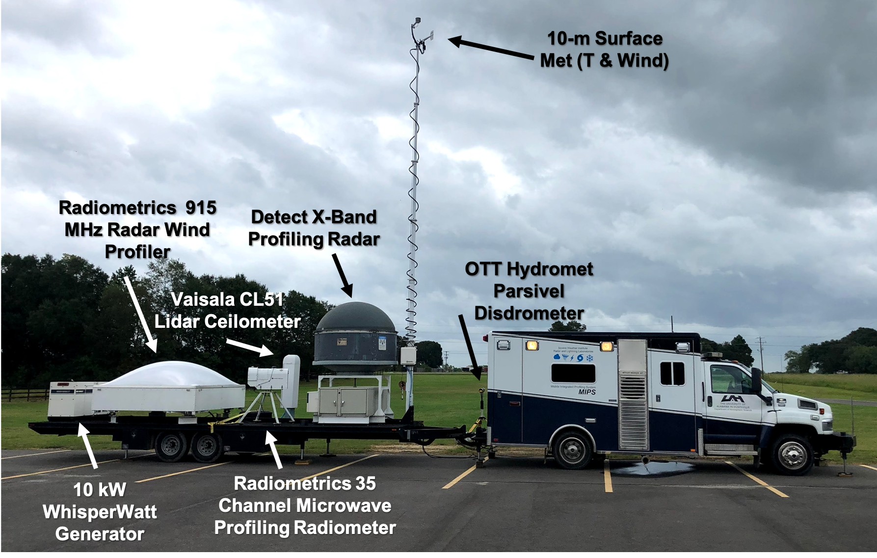
Mounted to a 28 ft flatbed trailer and pulled by a repurposed Chevrolet Ambulance, the MIPS system includes a 915 MHz Radar Wind Profiler (RWP), X-Band Profiling Radar (XPR), 35-channel microwave radiometer, lidar ceilometer, and in-situ meteorological surface sensors at two and ten meters. An optional Doppler acoustic sodar can accompany MIPS. The large area in the back of the truck allows up to four personnel to fit comfortably inside.
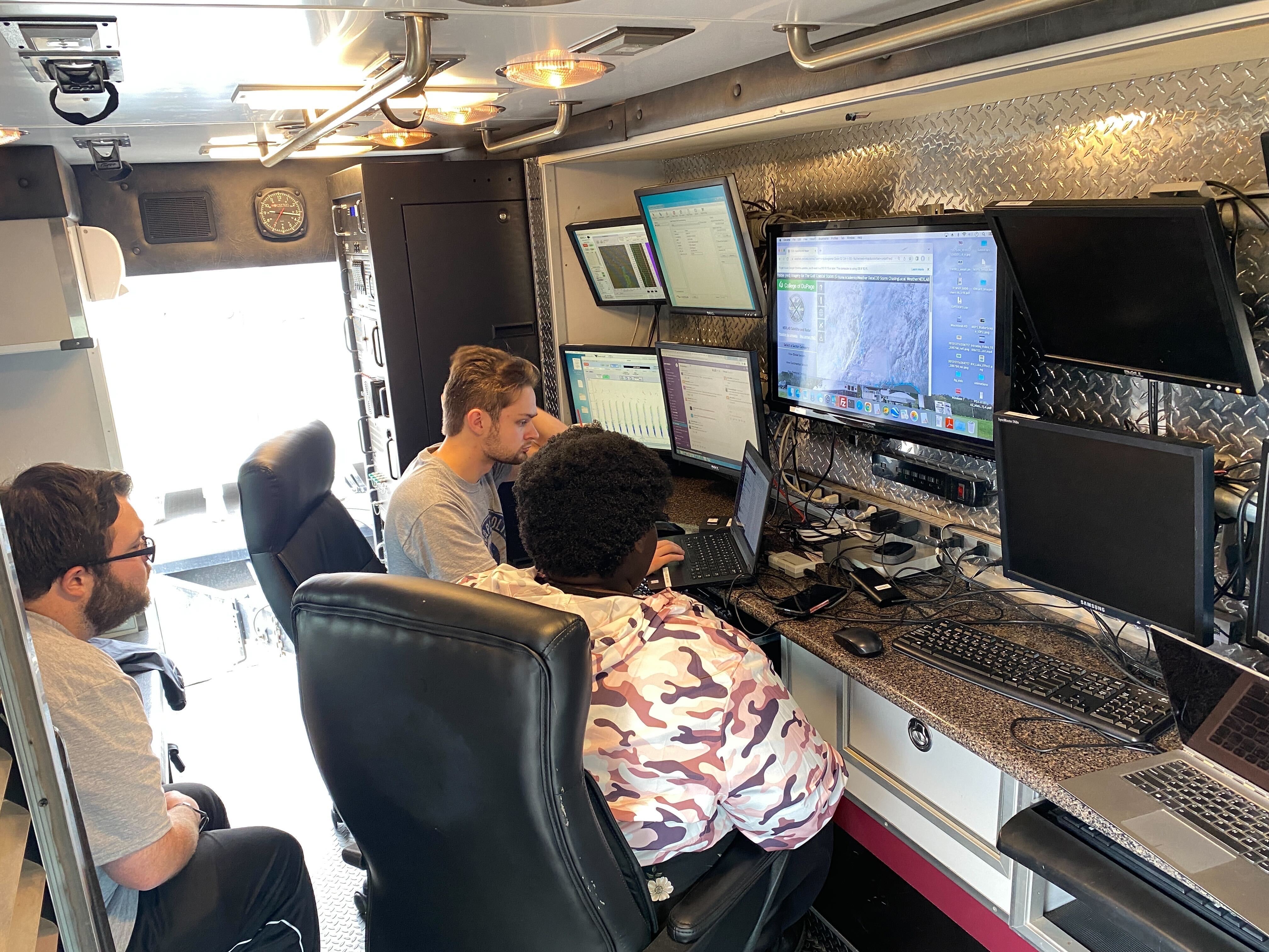
Students working inside MIPS while deployed for PERiLS. |
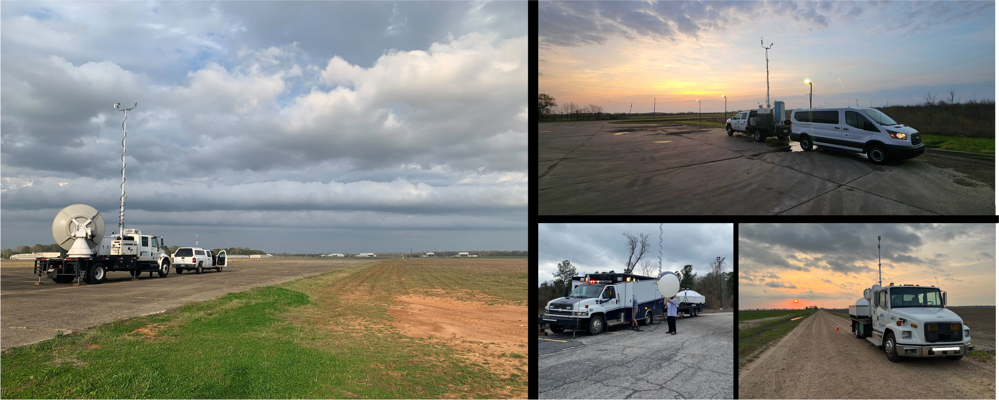
The MIPS deployed for Hurricane Laura (2020). |
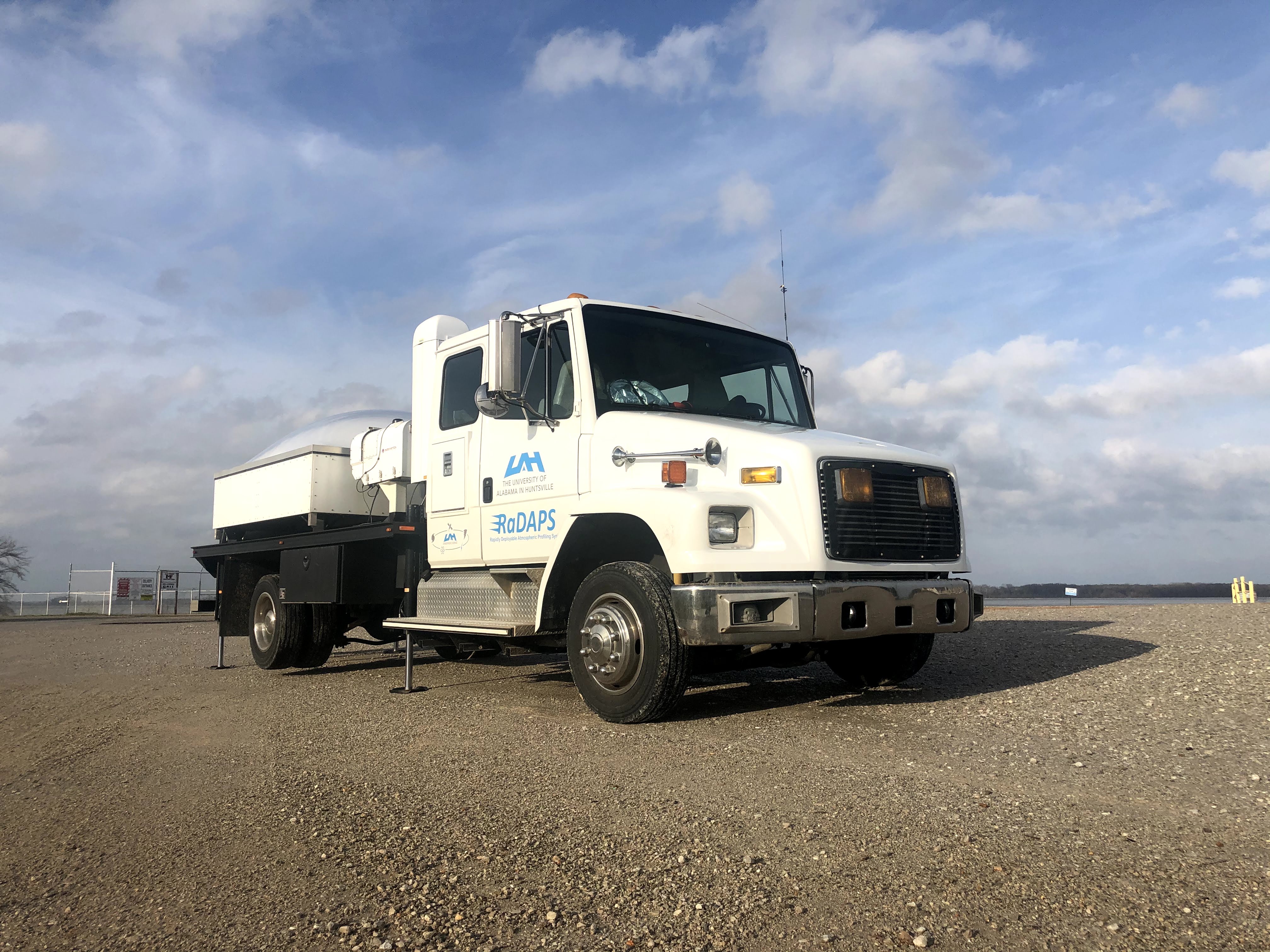
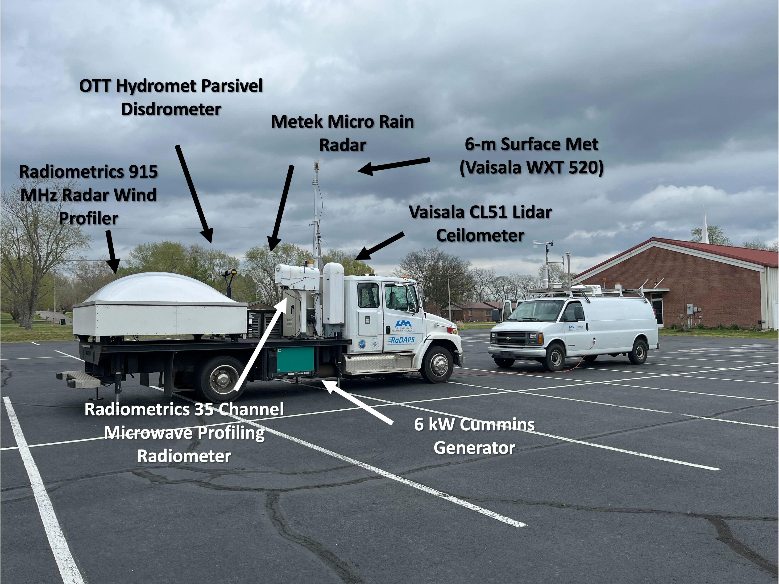
RaDAPS
Like MIPS, the RaDAPS truck is a converted medium duty ambulance. However, the patient area was removed and a 15ft flatbed was built onto the back of the truck. The system includes a similar setup to MIPS as it has a 915 MHz RWP, a 35-channel microwave radiometer, and lidar ceilometer. However instead of the XPR, it holds a Metek Micro Rain Radar (MRR-2). In-situ surface measurements are obtained at 6 meters using a telescoping mast. This system offers enough space for two personnel to work comfortably.
RaDAPS deployed at the Tennessee River for a VORTEX-SE deployment. |
RaDAPS deployed for a PERiLS deployment. |
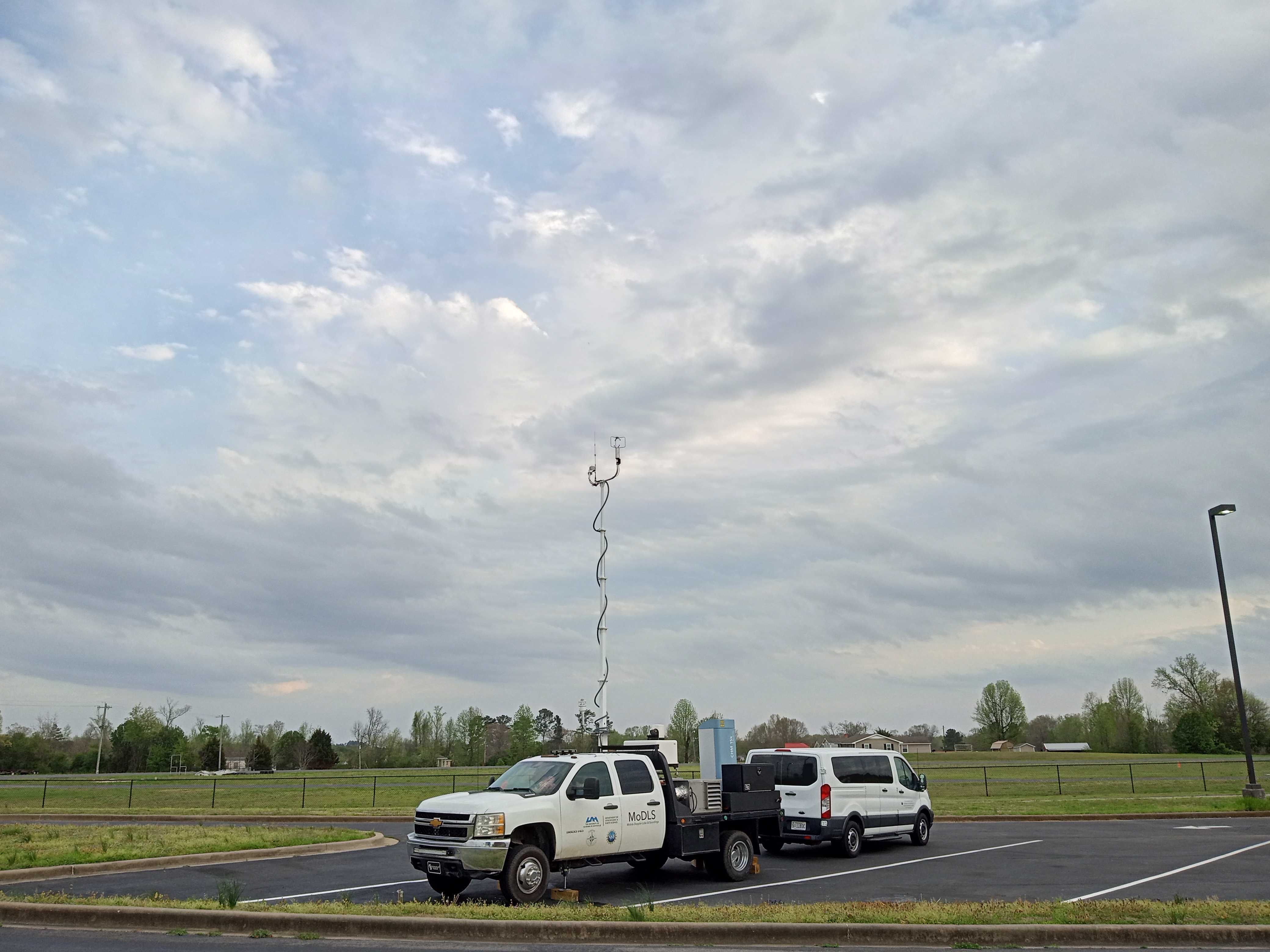
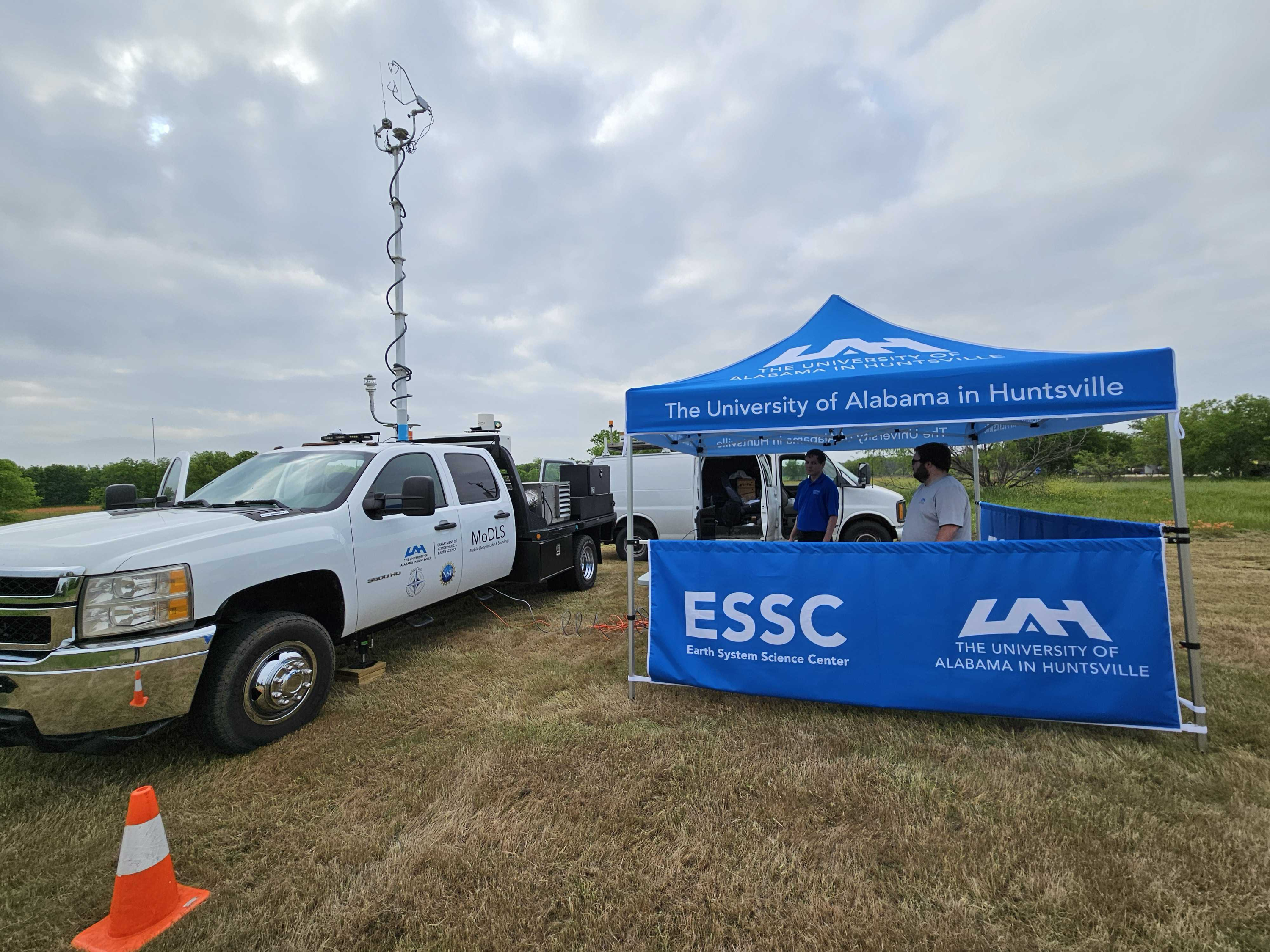
MoDLS
Designed to measure fine-scale boundary layer characteristics such as turbulence, winds, and structure, the MoDLS platform highlights a scanning Halo Photonics Doppler Wind Lidar (DWL), a 35-channel microwave radiometer identical to the MIPS and RaDAPS platform, and a sonic anemometer. A vertically pointing Ka-Band radar will be added late 2024. The instruments are mounted to Chevrolet 3500 flatbed pickup truck which makes the platform agile and provides rapid setup. The truck allows 2-3 personnel to work comfortably inside.
MoDLS fully deployed for solar eclipse. |
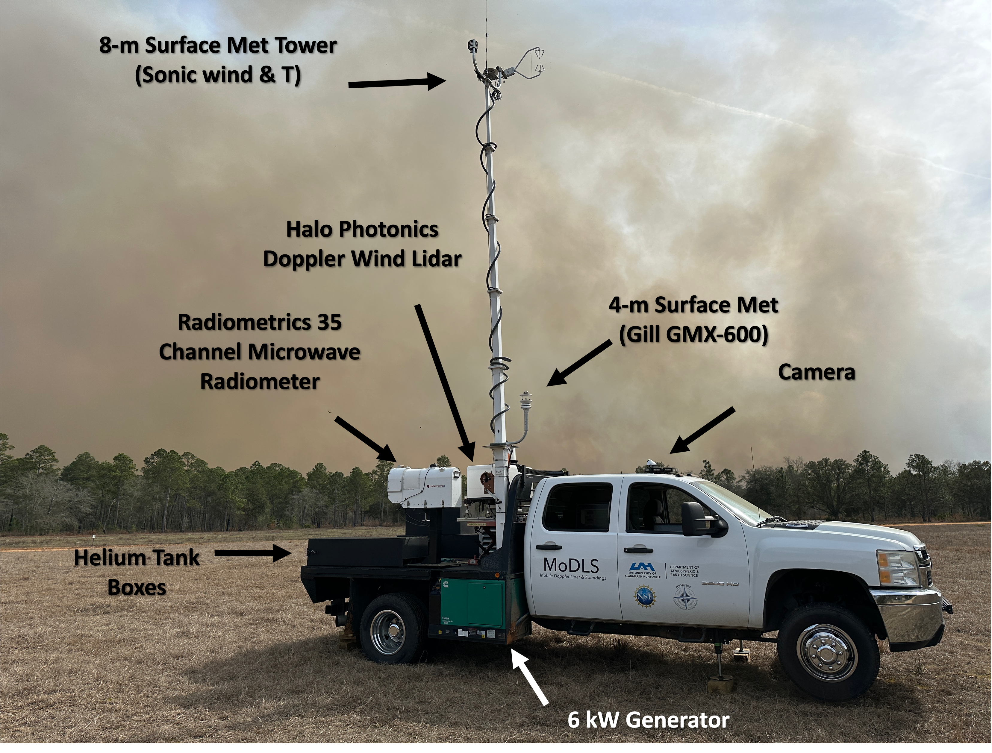
MoDLS deployed at Ft. Stewart for a prescribed burn in Feb 2024. |
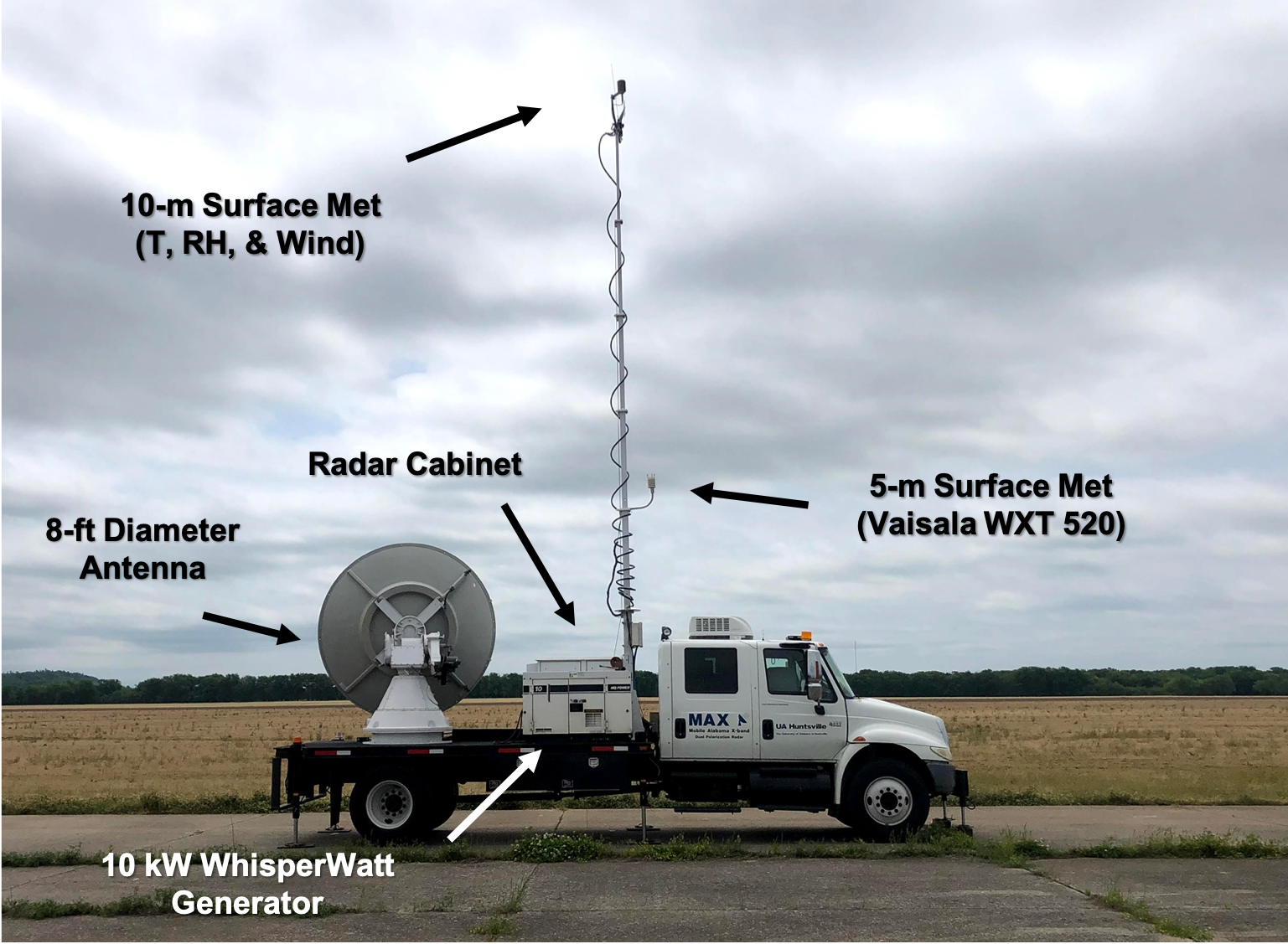
MAX
The MAX is a scanning X-band dual-polarization Doppler radar mounted on a flatbed built onto an International 4300 truck chassis. The radar has an 8-ft dish, 1.0 degree beam width, uses a 200 kW magnetron transmitter and Sigmet RVP-8 processer. The truck also holds a 10-m telescoping mast that has in-situ surface measurement sensors. This truck provides enough room for up to three personnel to work comfortably.
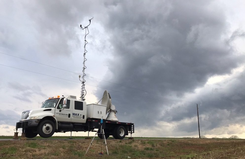
MAX deployed in support for VORTEX-SE. |
MAX deployed for severe weather in N AL. |