|
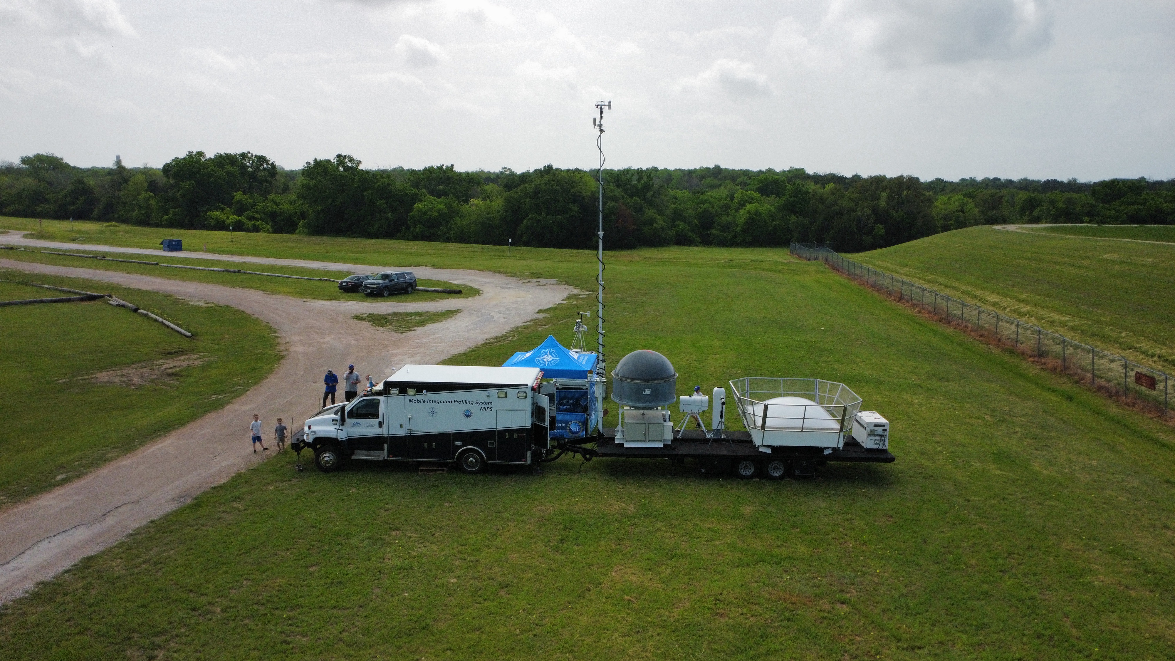
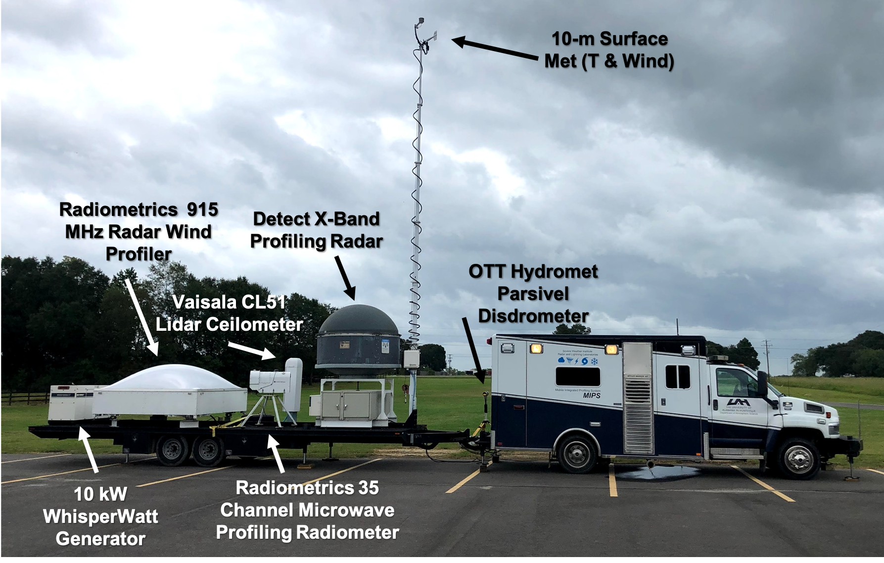
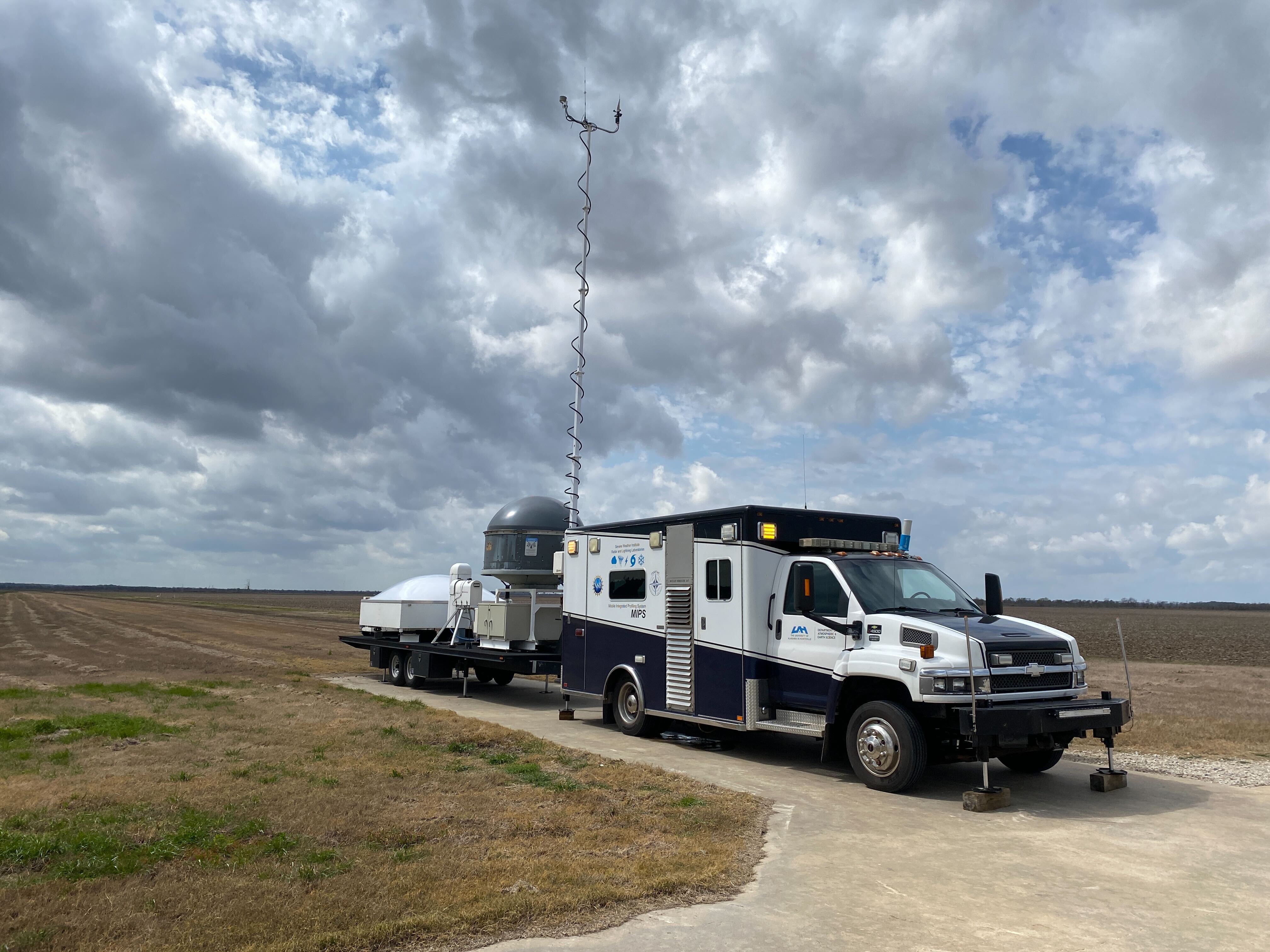
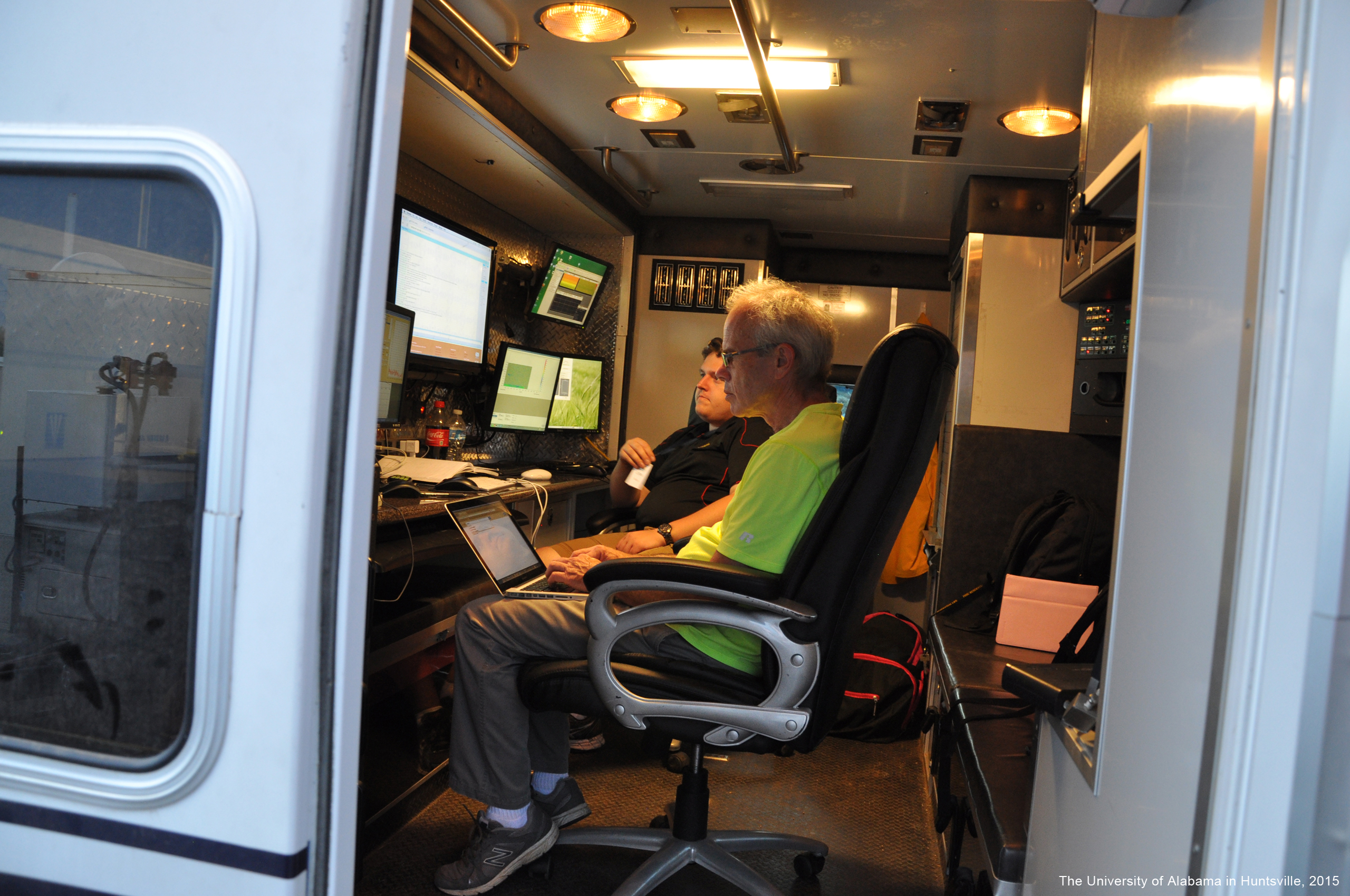
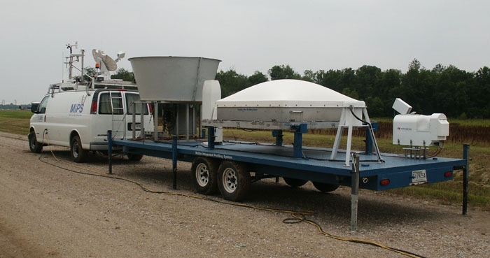
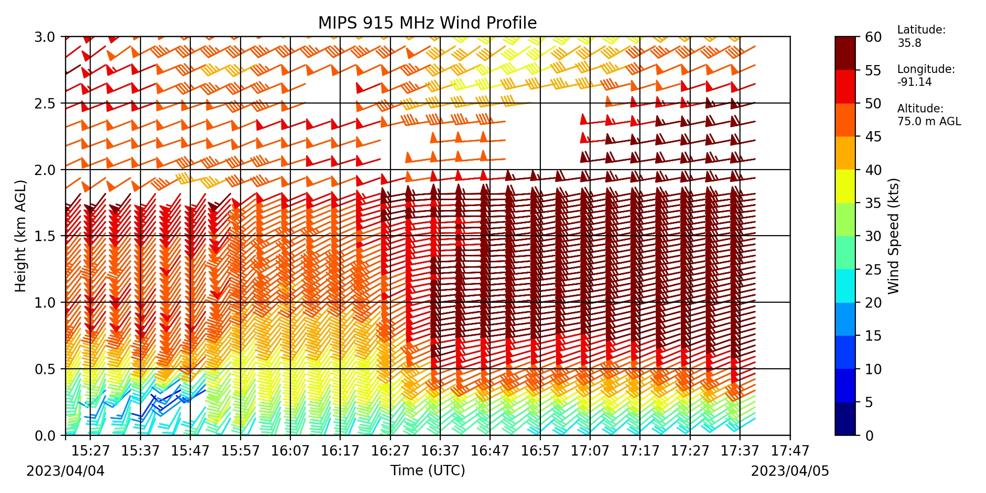
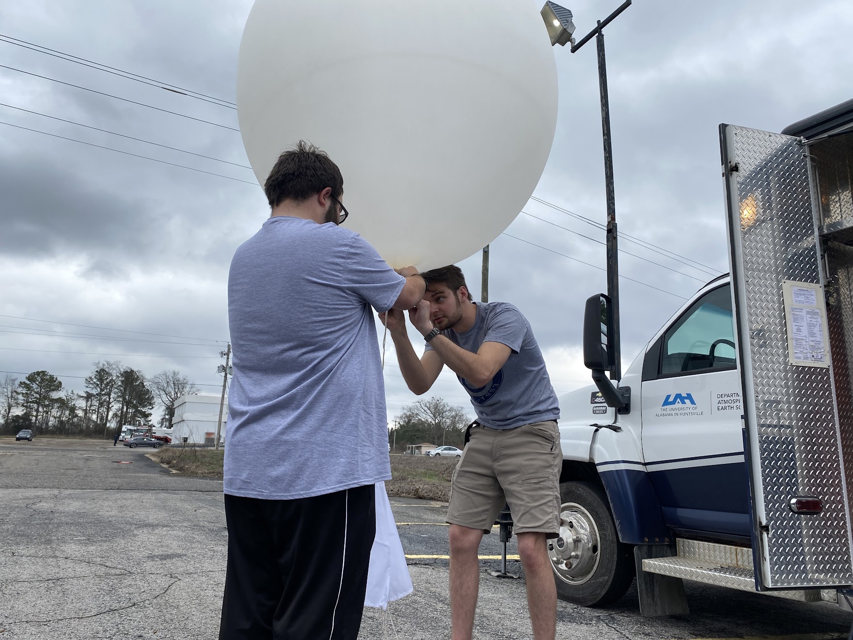
Serving as the first mobile ground-based remote sensing platform to be developed within the Atmospheric & Earth Science Department at UAH, the MIPS platform is deemed the flagship facility of MAPNet. The current configuration includes an upgraded 915 MHz RWP, upgraded lidar ceilometer, 35-channel microwave radiometer, vertically pointing X-Band Profiling Doppler Radar (XPR), a telescoping 10-meter surface measurements tower, parsivel disdrometer, and optional 4 kHz Doppler sodar. With these combined measurements, the MIPS has the capability to document high temporal boundary layer winds and thermodynamics, as well as precipitation and cloud/aerosol characteristics and kinematics through a variety of “wet” and “dry" conditions. The patient area of a medium-duty Chevrolet C4500 cab has been converted to a full 9-computer screen workstation that holds electrical components and control computers (1 mac, 3 Linux machines, and 1 Windows machine). The instruments have been mounted to a custom-built 28-ft trailer. Four hydraulic leveling jacks are mounted to the trailer that provide optimal stabilization and leveling for deployments. Four hydraulic leveling jacks are also mounted to the truck to provide a level and stable workstation. The larger workspace provided by the ambulance allows up to four personnel to work comfortably. Two VHF mobile radios are located inside MIPS (one located at the driver’s seat for driving and one located in the rear for communications when operational). A 10-kW diesel generator is used to power the instruments and equipment onboard. A 50-gallon diesel fuel tank is mounted underneath the trailer that can be used to refuel the generator for longer deployments. Switches and a fuel gauge located inside the work area of MIPS removes the need for personnel to go outside to monitor or refuel the generator. A 30,000 BTU AC unit provides more than adequate heated or cooled air to both personnel and computers. With the capacity to fit four personnel, multiple operating systems, and ability to quickly communicate with others in the field, the MIPS platform can serve as a mobile operations center. HistoryThe development started in 1992 with the purchase of a 915 MHz radar wind profiler. By 1998, platform development began. The first iteration of the MIPS was completed and included a 1999 Chevy Express Van which pulled a trailer packed with a 5-beam 915 MHz radar wind profiler (RWP), a 2-kHz sodar, a lidar ceilometer, and a 12-channel microwave profiling radiometer (MPR). After many years of traveling across the nation (CAMEX, IHOP, BAMEX, MIRAGE, PLOWS, ABIDE, PECAN, VORTEX-SE, many hurricane deployments, several aerosol studies, and other local deployments), the MIPS system has been changed several times. While the types of instruments aboard MIPS have mostly stayed the same, upgrades over the years including truck, trailer, and instruments have made the MIPS system rugged, user-friendly, and comfortable. |
The MIPS Instruments:
The current MIPS configuration. 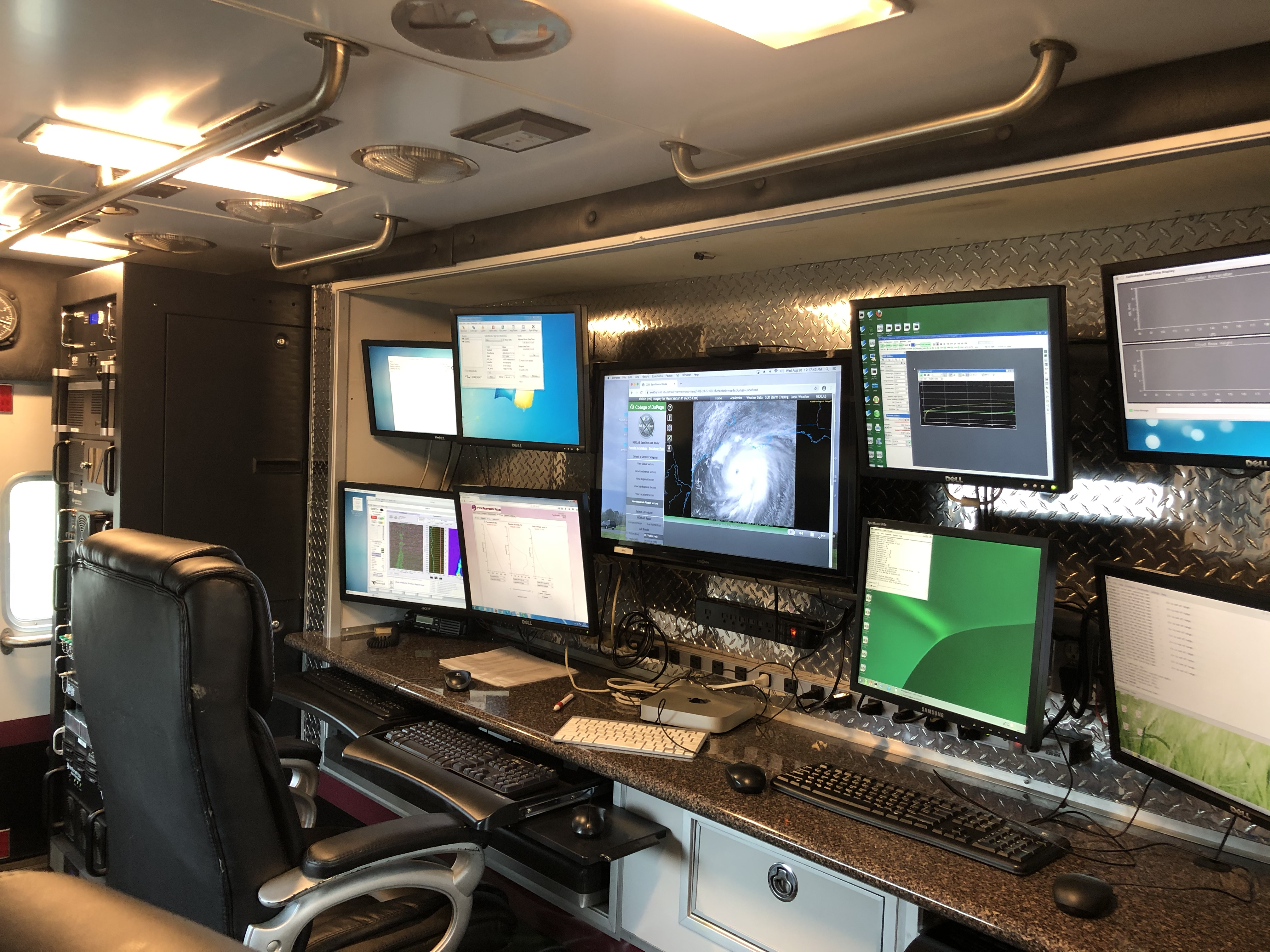
Inside MIPS while deployed for hurricane Laura (2020). 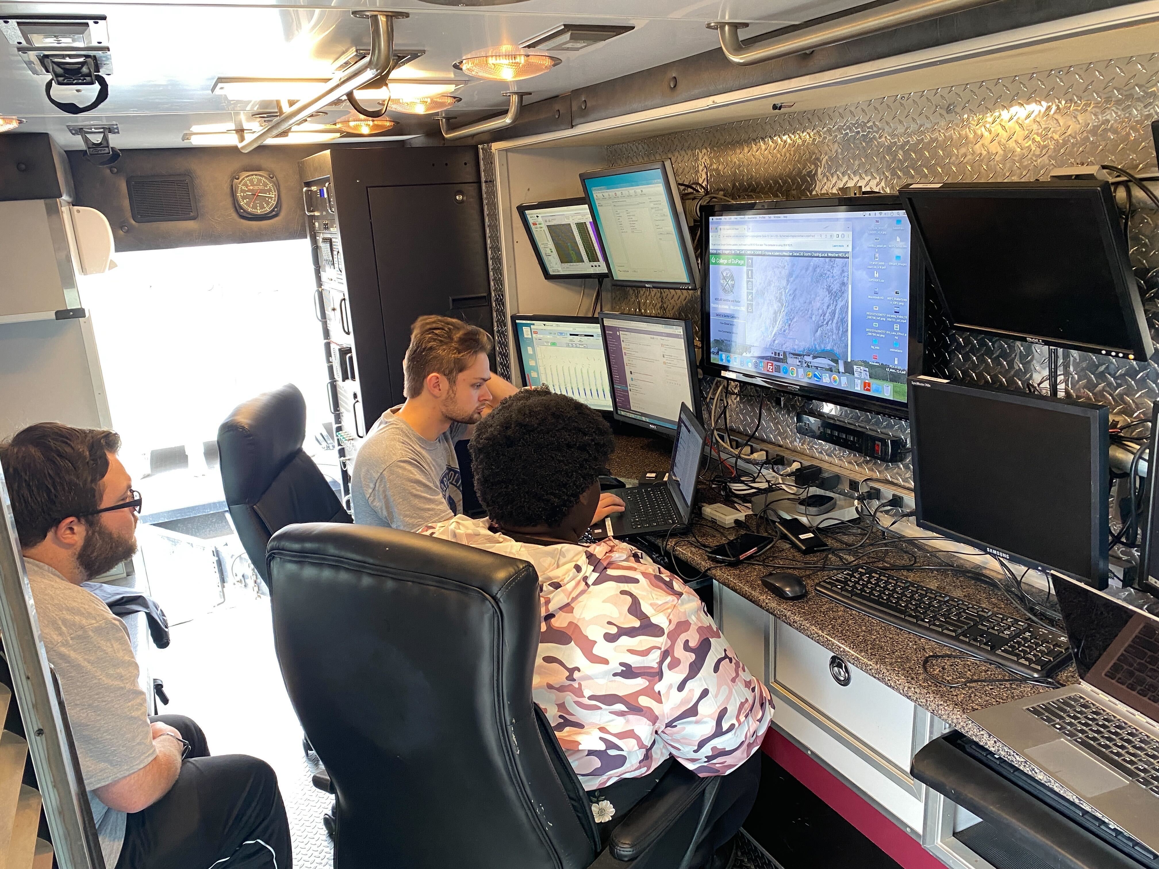
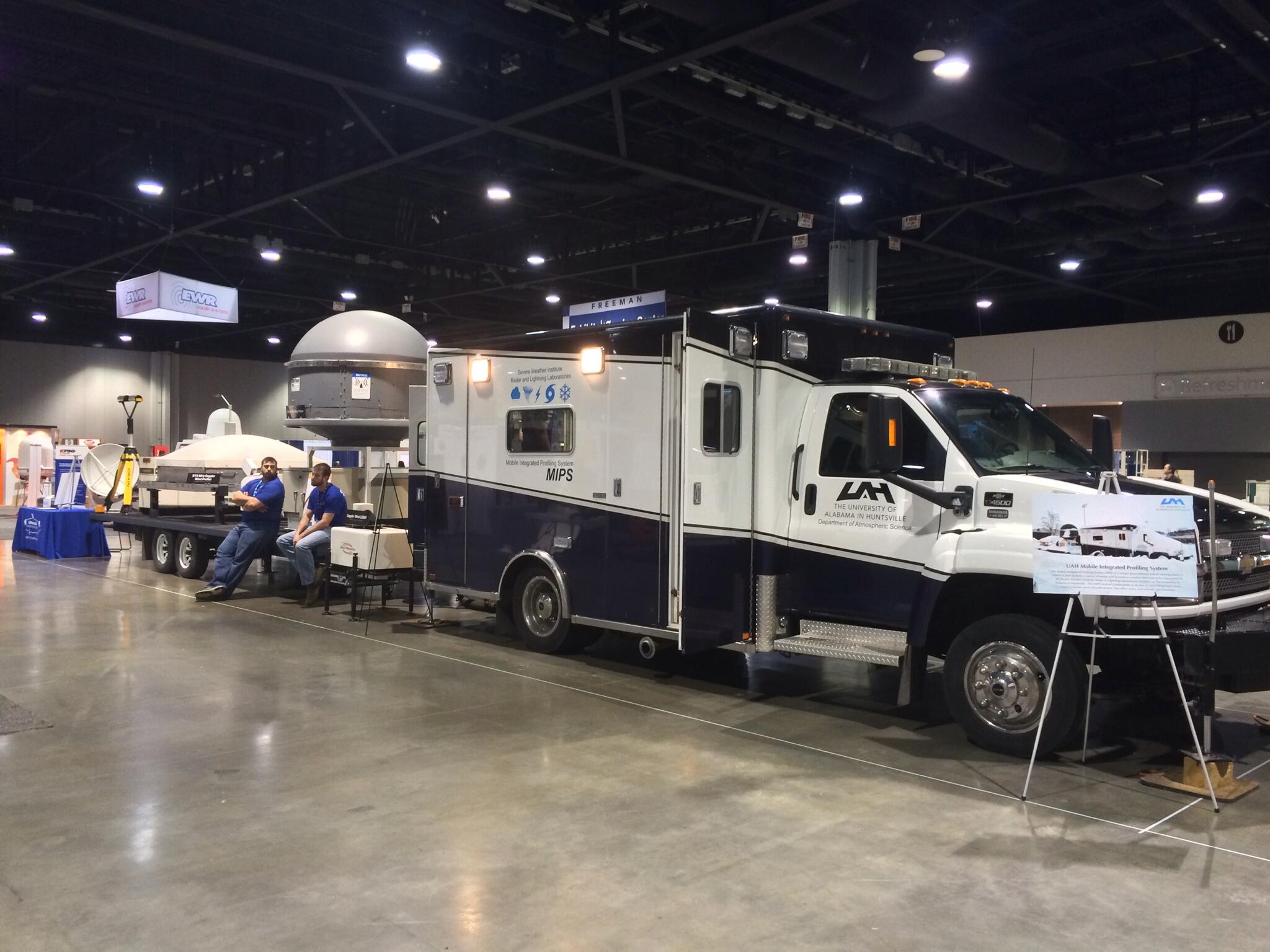
MIPS on display at the 2014 AMS Annual Meeting in Atlanta, GA. 
MIPS set up for the 2017 Solar Eclipse in Kentucky. 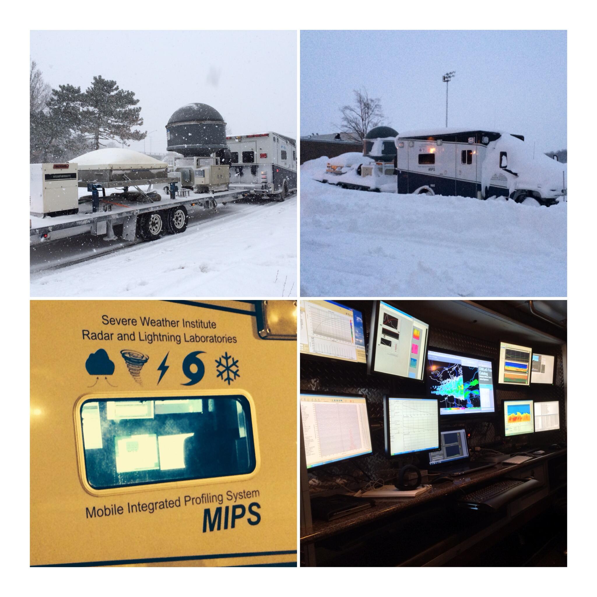
MIPS deployed in Buffalo, NY for lake effect snow. |
