
NSF REU Lake Wheeler Lake Breeze ExperimentCentered over the Lake Wheeler region of North Alabama, this lake breeze experiment was an educational deployment designed to prioritize student learning and enrichment as well as study the lake breeze phenomenon around the Lake Wheeler area. Through the use of the MAPNet facilities, this experiment educated students on the process of designing, planning, and execution of a field project. Student InvolvmentDuring the course of the Summer of 2022, the UAH SWIRLL facility hosted 10 undergraduate students who worked on research under the NSF Research Experience for Undergraduates (REU) program. Many of the students did not have access to the kinds of instruments included in the MAPNet facilities at their home institutions. Therefore, the integration of the MAPNet facilities with the REU students was organized to provide a unique learning experience that they could not get anywhere else. Within their 10-week visit at SWIRLL, the REU students were asked to design a field experiment to study the Lake Wheeler lake breeze. Through this exercise, students would learn what it takes to design, plan, and execute a field project. In addition, students would gain hands-on experience with ground-based remote sensing platforms and how the data collected can be used to interpret atmospheric phenomena. Experimental DesignLake Wheeler is nestled along the Tennessee River and is situated in the Northwestern portion of Alabama. Because the lake itself is not very large, the lake breeze circulation is localized and typically only affects a very small portion of the region. Under certain conditions, the lake breeze can enhance convective initiation (CI) and lead to localized thunderstorms along the convergence zone. With some guidance from the REU organizers and MAPNet staff, the REU students designed the experimental network needed to answer some outstanding scientific questions about the lake breeze. 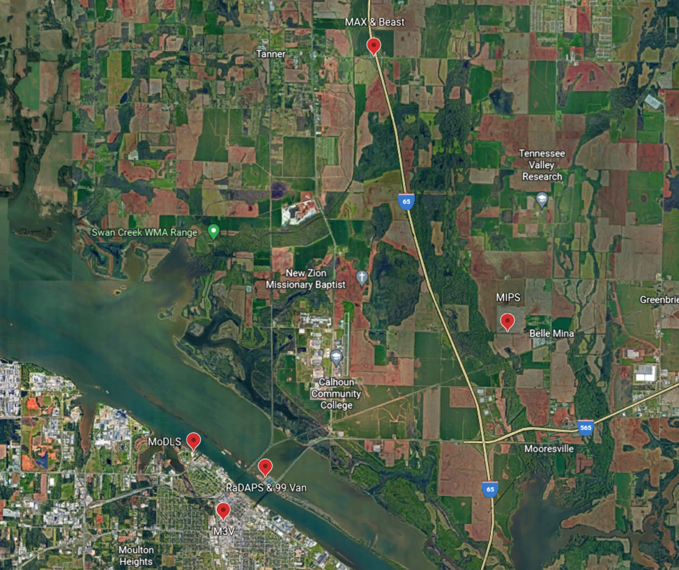
Experimental design that was developed by the REU students. The students were broken up into three groups based on the following topics to be studied:
After being assigned to their respective groups, the students were asked to design a network using the MAPNet facilities based on their group. The groups then came together as a committee to decide the best network needed to collect data for all three areas of interest. This simulation allowed students to explore the complexities involved with the planning stages of a field campaign and how remote sensing platforms can be combined in a network. |
Educational Deployments
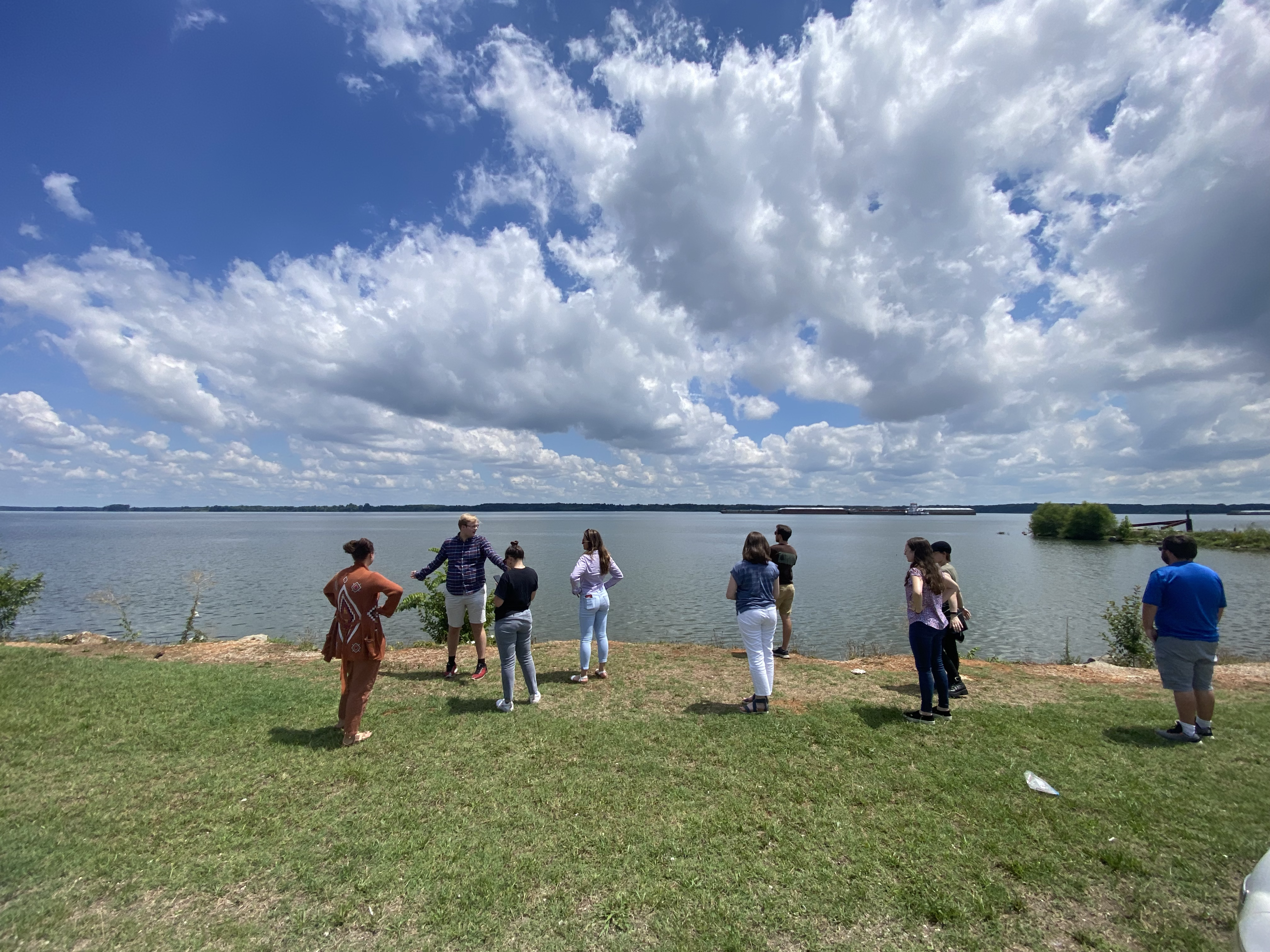
Students out surveying sites prior to the deployment. 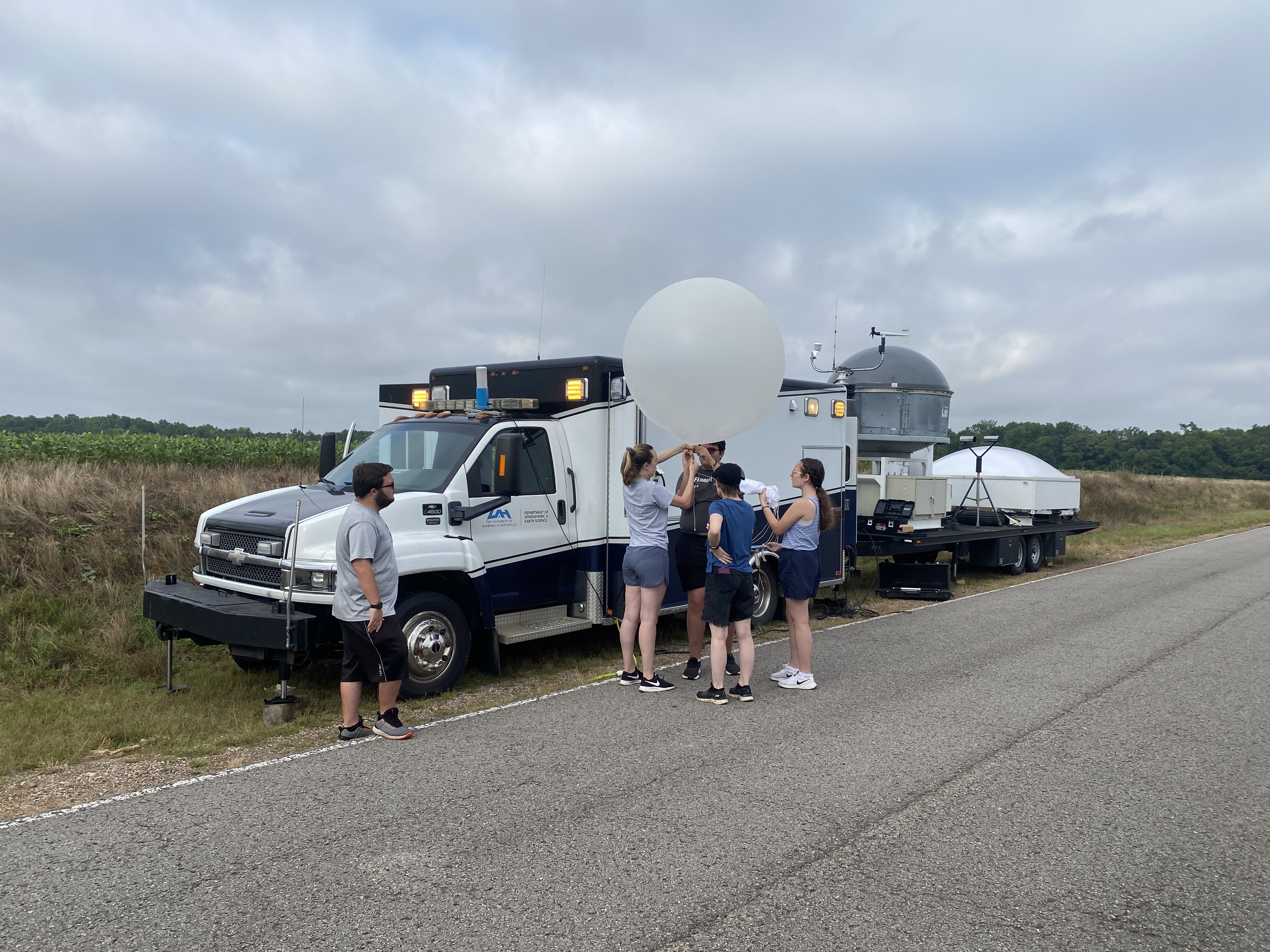
The first balloon of the day being prepped at the MIPS site. 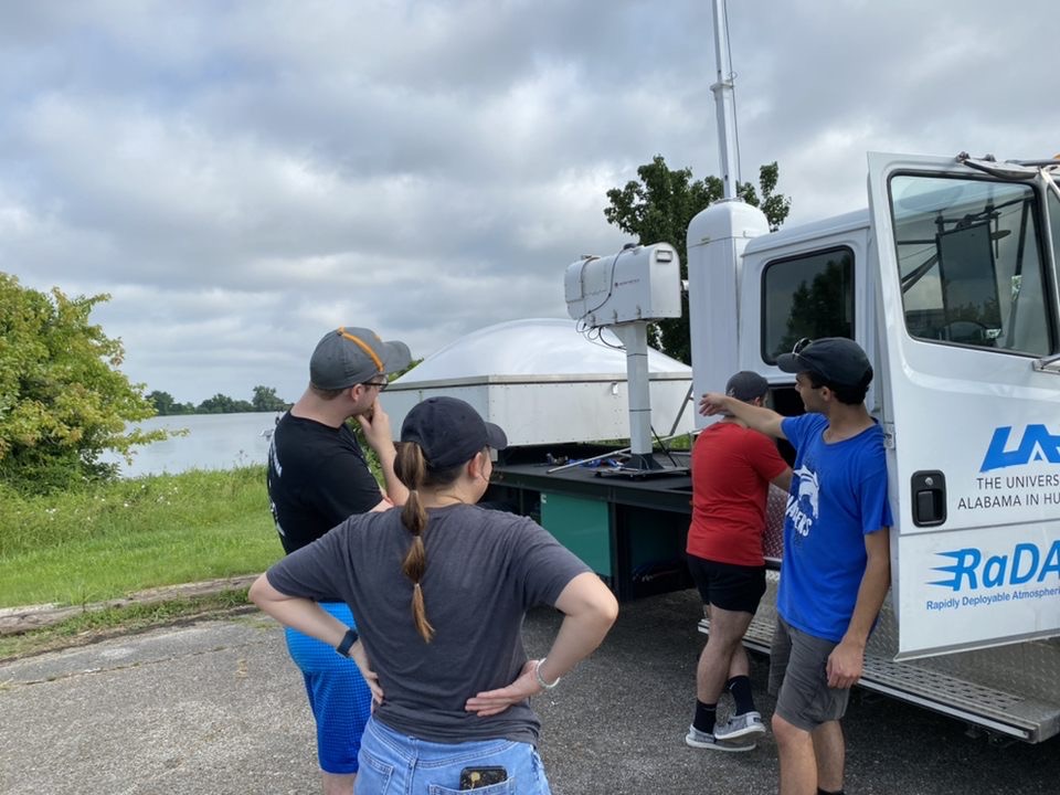
The experiment provided students hands-on experience and learning with ground-based remote sensing platforms. 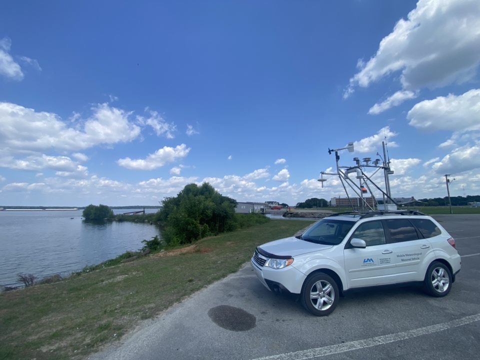
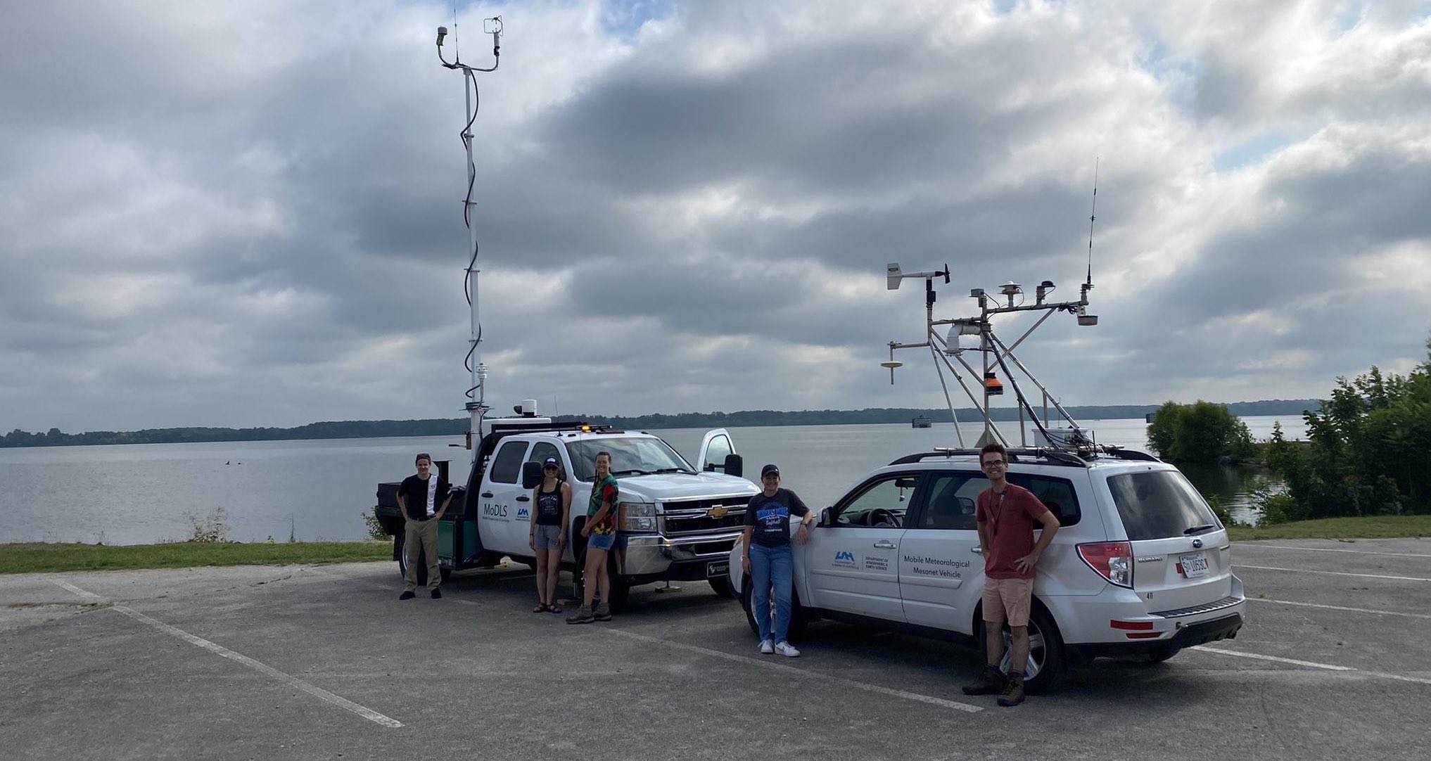
The MAPNet mobile mesonet vehicle collecting surface measurements along the river. |