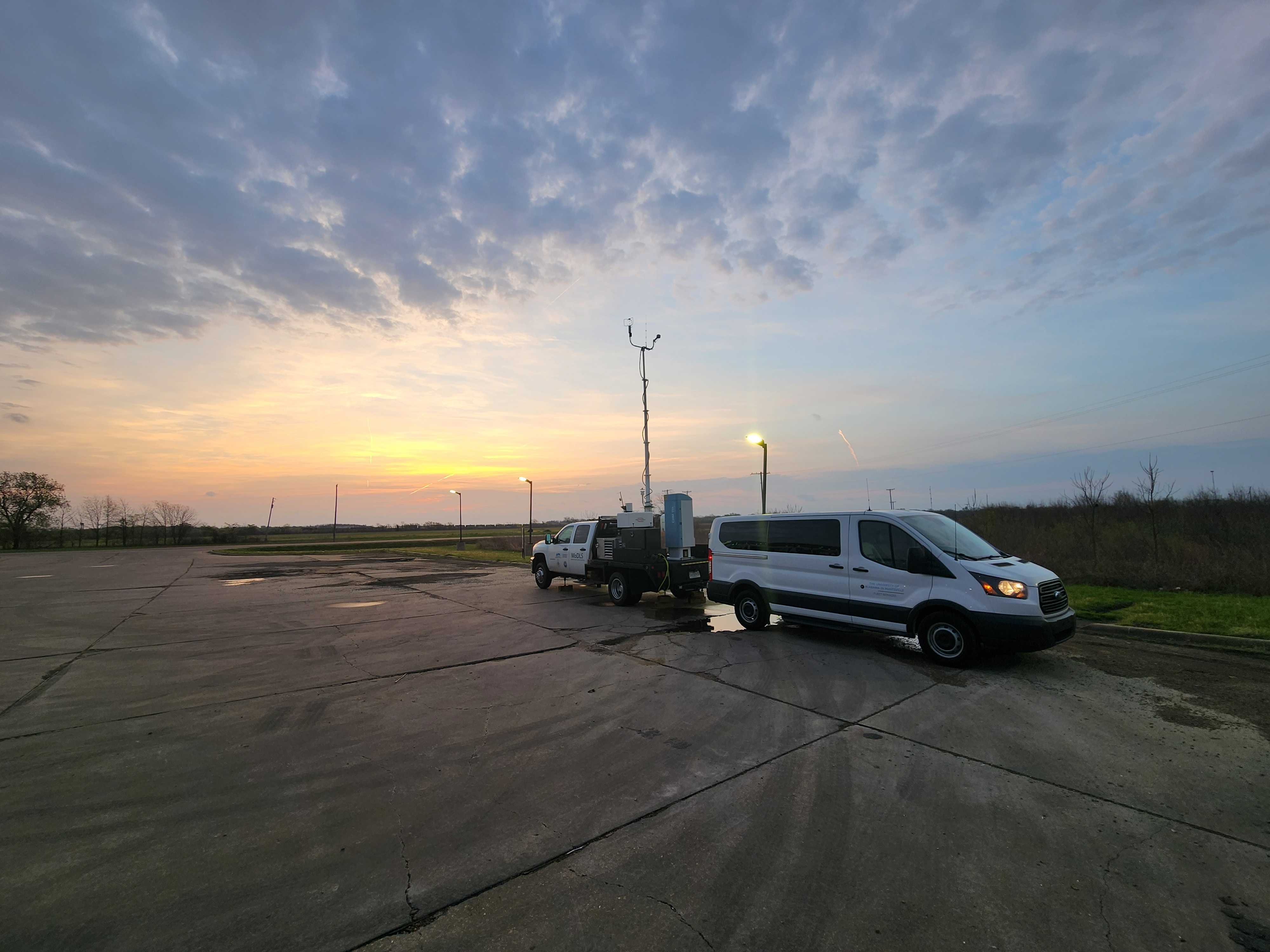
|
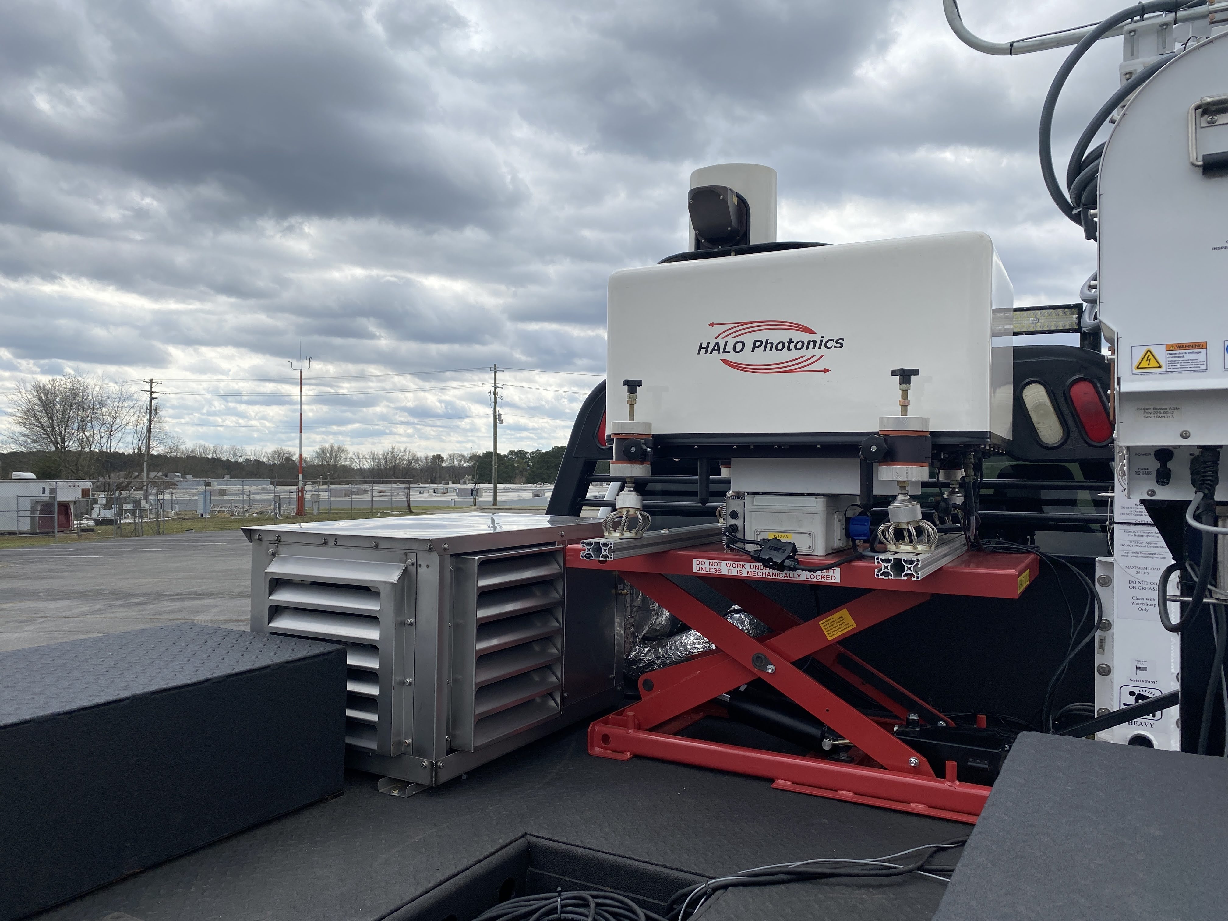
MoDLS utilizes the Halo Photonics Streamline Doppler Wind Lidar. With a wavelength of 1.5 microns, boundary layer winds, turbulence, and aerosol loading can easily be determined. The lidar can be operated in various configurations including 1-Hz vertically pointing measurements, range-height indicator (RHI) slices, plan position indicator (PPI) scans and sector scans at any azimuths or elevations, and velocity azimuth display (VAD) scans. The current standard operational configuration includes a 15° 8 point VAD scan and 60° 6 point VAD scan every 5 minutes and 1-Hz vertical stare when not performing the VAD scans. All scans provide particle backscatter, radial velocity, and signal-to-noise ratio. The range resolution and pulse length is adjustable to meet any profiling needs. With an internal computer, the lidar can be removed and operated as a stand-alone unit which provides flexibility if a remote location is required. |
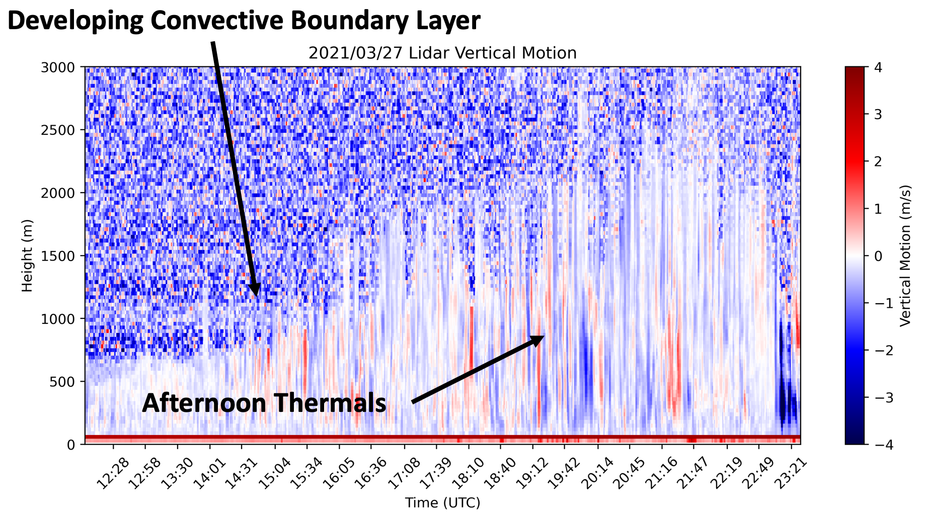
DWL velocity data from 27 March 2021 showing a building convective boundary layer and afternoon thermals. 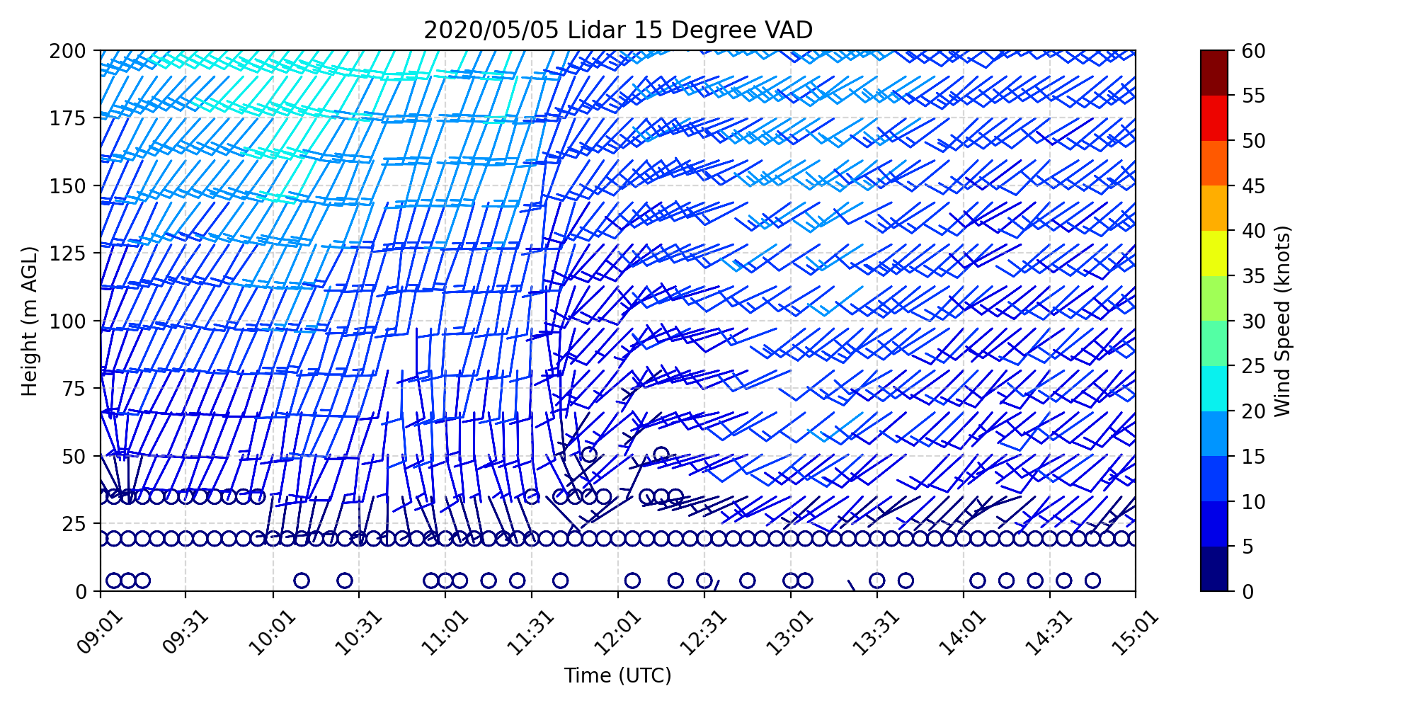
Lidar 15 deg high-resolution VAD data depicting capturing a sudden wind shift that is assoicated with a current passage. 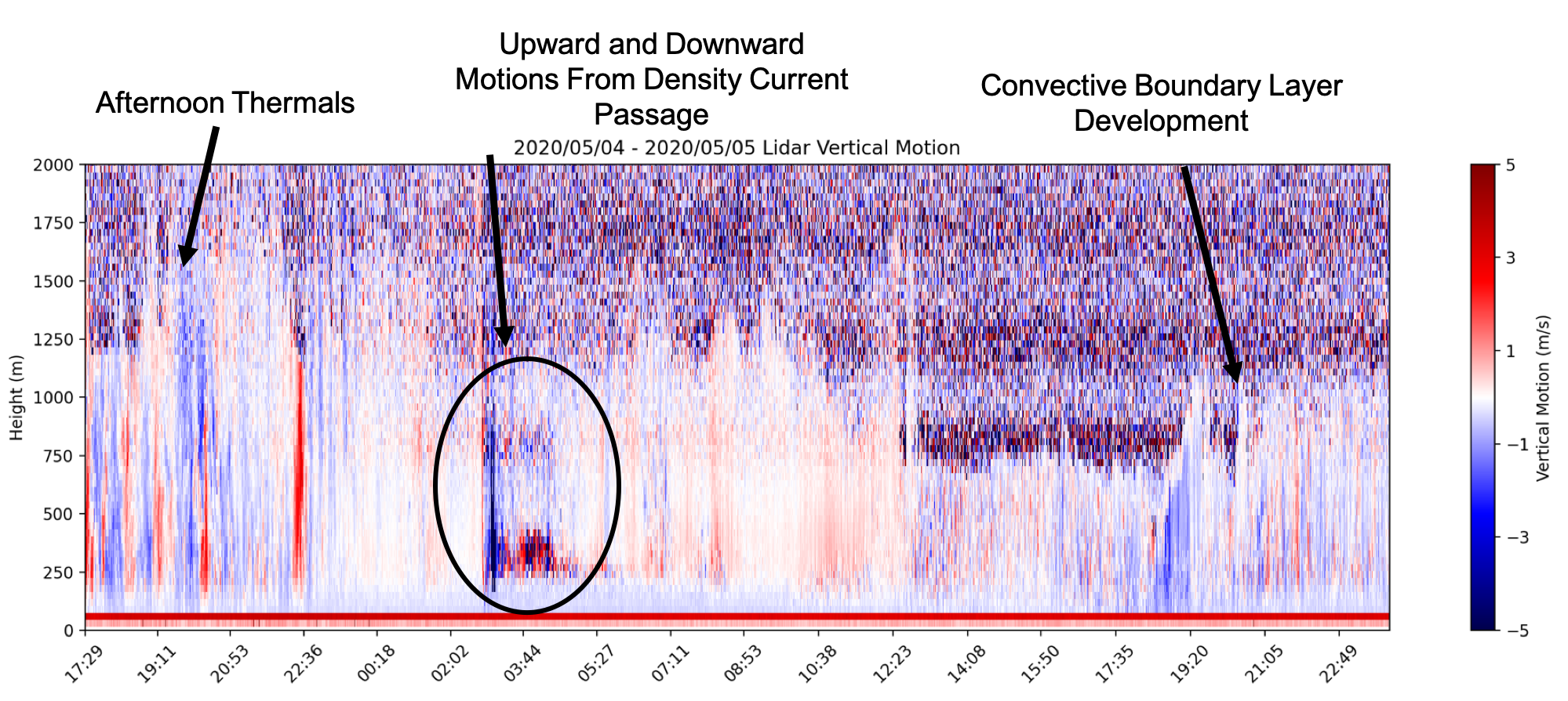
Vertical velocity data from 5 May 2020 that shows multiple dynamic features. |
×

