 |
||||||||||||||||||||||||||||||||||||||||||
Volume 2, Number 3, December, 2011 |
||||||||||||||||||||||||||||||||||||||||||
|
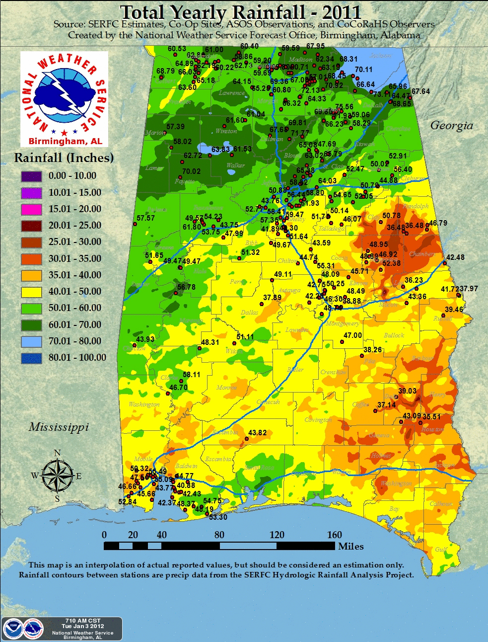
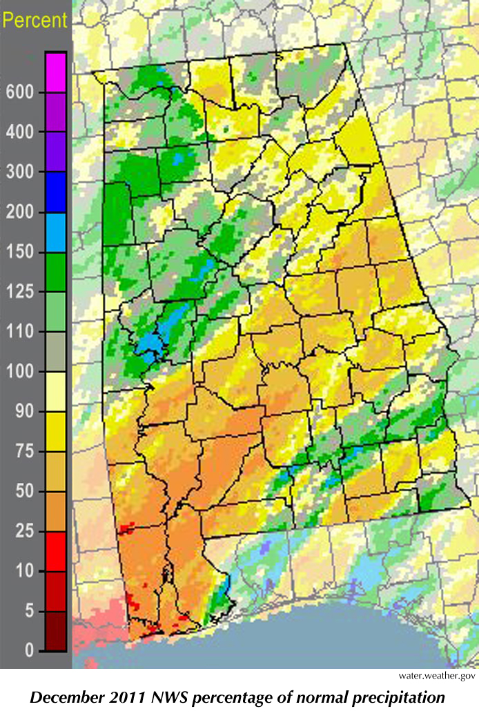
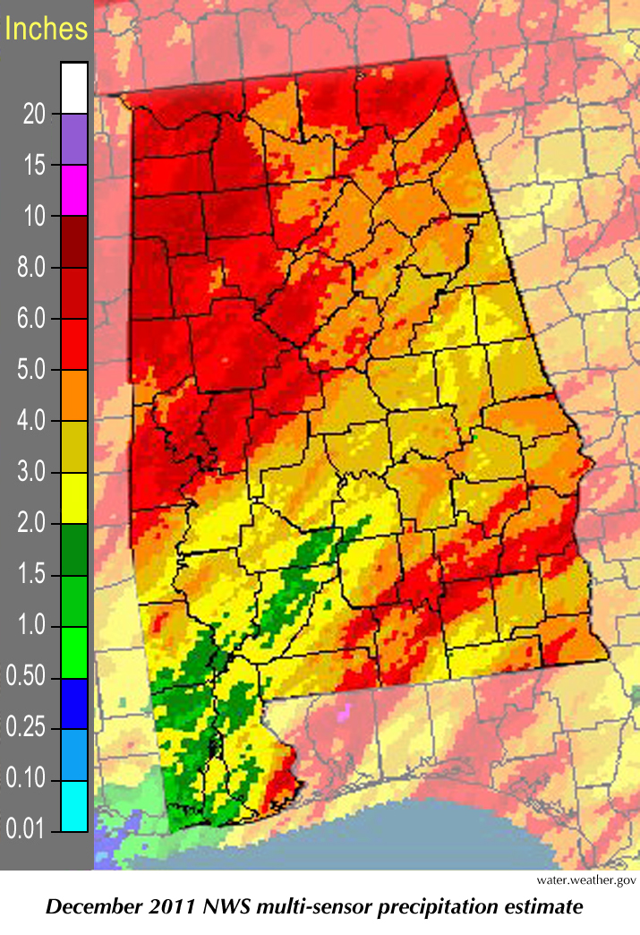
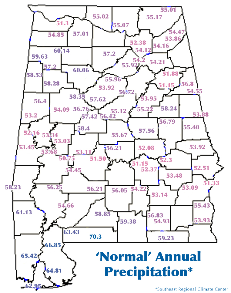
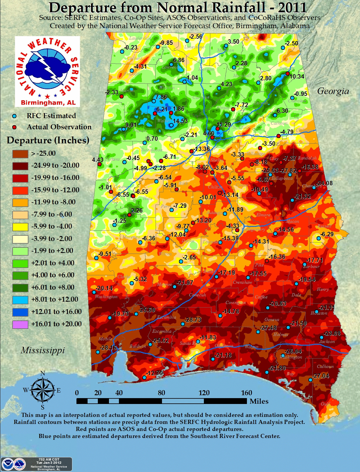
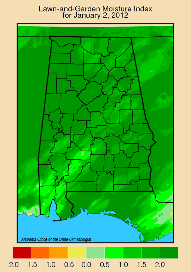
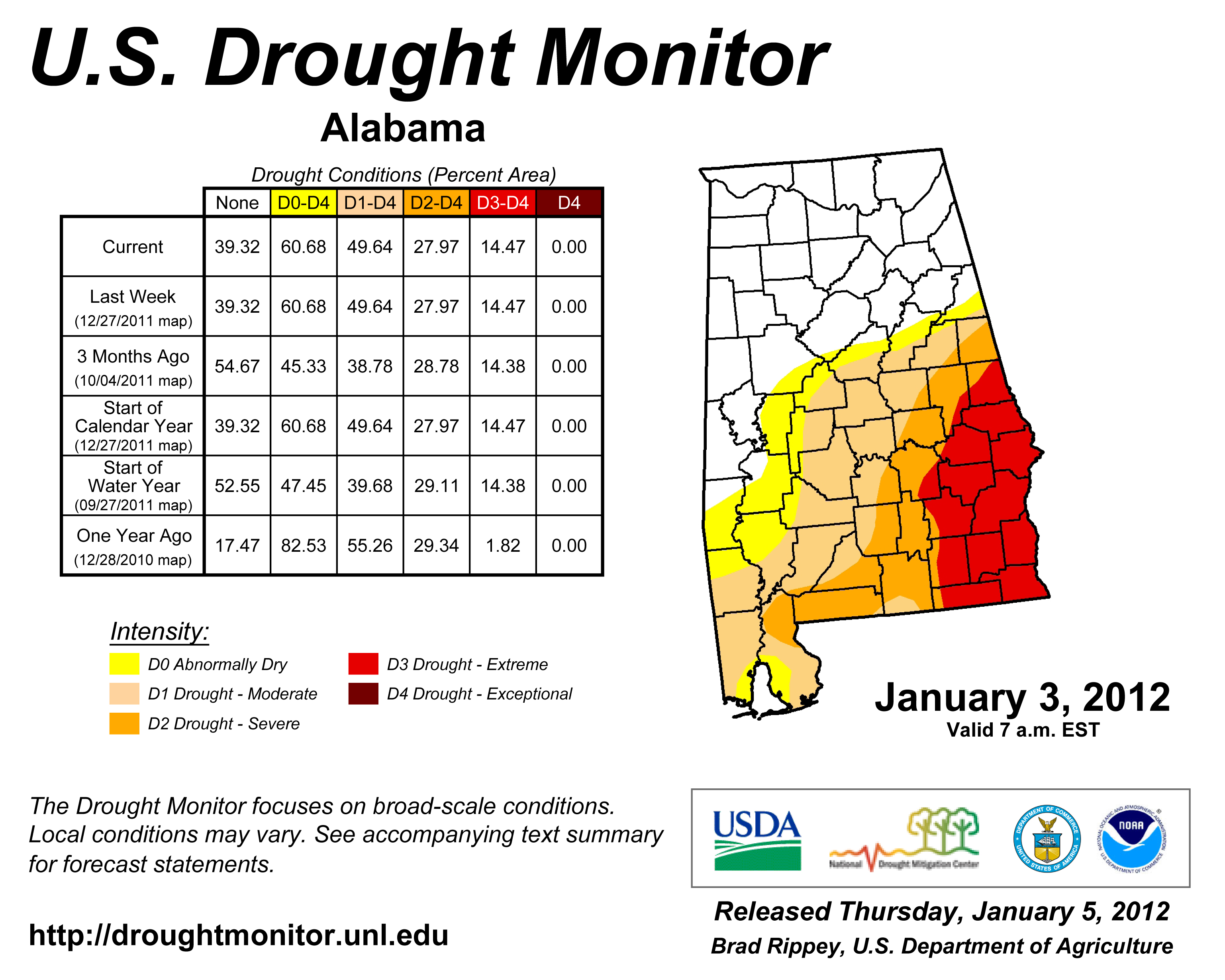
From a weather and climate perspective, 2011 was a terrible year in Alabama. Not only did we suffer the second deadliest outbreak of tornadoes in state history (with 242 people killed and another 2,110 injured by tornadoes during the year), but we also saw a lingering drought that damaged farms and gardens across much of the state. 268 Alabamians died in the March 31, 1932, outbreak. Between a third and half of the state had significantly lower rainfall -- at least six inches less than normal -- last year. About one third of the state had major drought damage, with 12 or more inches less rain than they would normally receive. A handful of spots across the northwestern half of the state saw significantly more rain than usual. It was as if the storm systems that moved through the state ran out of steam or decided to stop raining not long after they hit I-20. This is a typical rainfall pattern for a La Nina year when tropical Pacific waters are colder than usual. That pattern set up some extreme contrasts. A handful of sites in Jackson, Marshall and Madison counties saw more than 70 inches of rain for the year. A gauge near Guntersville recorded 75.56 inches while one near Section hit 73. That is about 20 inches above normal for those sites. One NWS gauge recorded more than 65 inches of rain that fell last year on the Pinson area of northeastern Jefferson County, about eleven inches more than falls there in a normal year. Not much more than an hour's drive east in Tallapoosa County, the NWS estimates that total rain for the year was almost 28 inches under normal in one spot. That's about half of what that area would get in an average year. The state had several pockets of extreme drought. Normally one of the wettest places in the state, Brewton saw almost 29 inches less rain than normal; Mobile was 28 inches below normal while Bay Minette was 25.6 inches below normal. Both the drought monitor, and the lawn and garden index for this month show conditions improving, thanks in large part to rain that fell in December. While that is good, without ponds and reservoirs to capture it, the rain that falls during the Alabama winter does little to relieve water shortages during the rest of the year. Then too, the snow season of 2010-11 was one of the heaviest in recorded history. Most of North Alabama had five to eight measurable snowfalls, which is ... unique. And total snowfall in several places topped 14 inches between December and February. While not a record breaker, that puts it among the ten snowiest winters in the past 100 years. The biggest weather story of the year (by general consensus the state's top news story of any kind in 2011) was the April 27 tornado outbreak. By any measure it was what we might reasonable hope was a once-in-a-lifetime outbreak, far outstripping the monetary and infrastructure damage of either the April 3, 1974, or the March 21, 1932, storms. The April 27 storm system generated 62 tornadoes in one day, including seven EF-3s, six EF-4s and two deadly EF-5 tornadoes. Alabama had not seen an EF-5 since the April 8, 1998, tornado that hit Tuscaloosa and Jefferson counties, killing 32 people and injuring 259. Even before the April 27 storms, we had already had a bad year for tornadoes: The eight EF-3 tornadoes that caused seven fatalities and 18 injuries before April 27 was only one less than the total from 2002 to 2010. The 23 EF-3 or stronger tornadoes in 2011 was two more than Alabama saw in all of the preceding decade. |
|
||||||||||||||||||||||||||||||||||||||||
| - John Christy | ||||||||||||||||||||||||||||||||||||||||||
|
||||||||||||||||||||||||||||||||||||||||||
 |
||||||||||||||||||||||||||||||||||||||||||
| Copyright (c) 2010-2011 Alabama Office of the State Climatologist. All rights reserved. questions about this web page? Contact webmaster. |
||||||||||||||||||||||||||||||||||||||||||