Volume 16, Number 8 February 2025
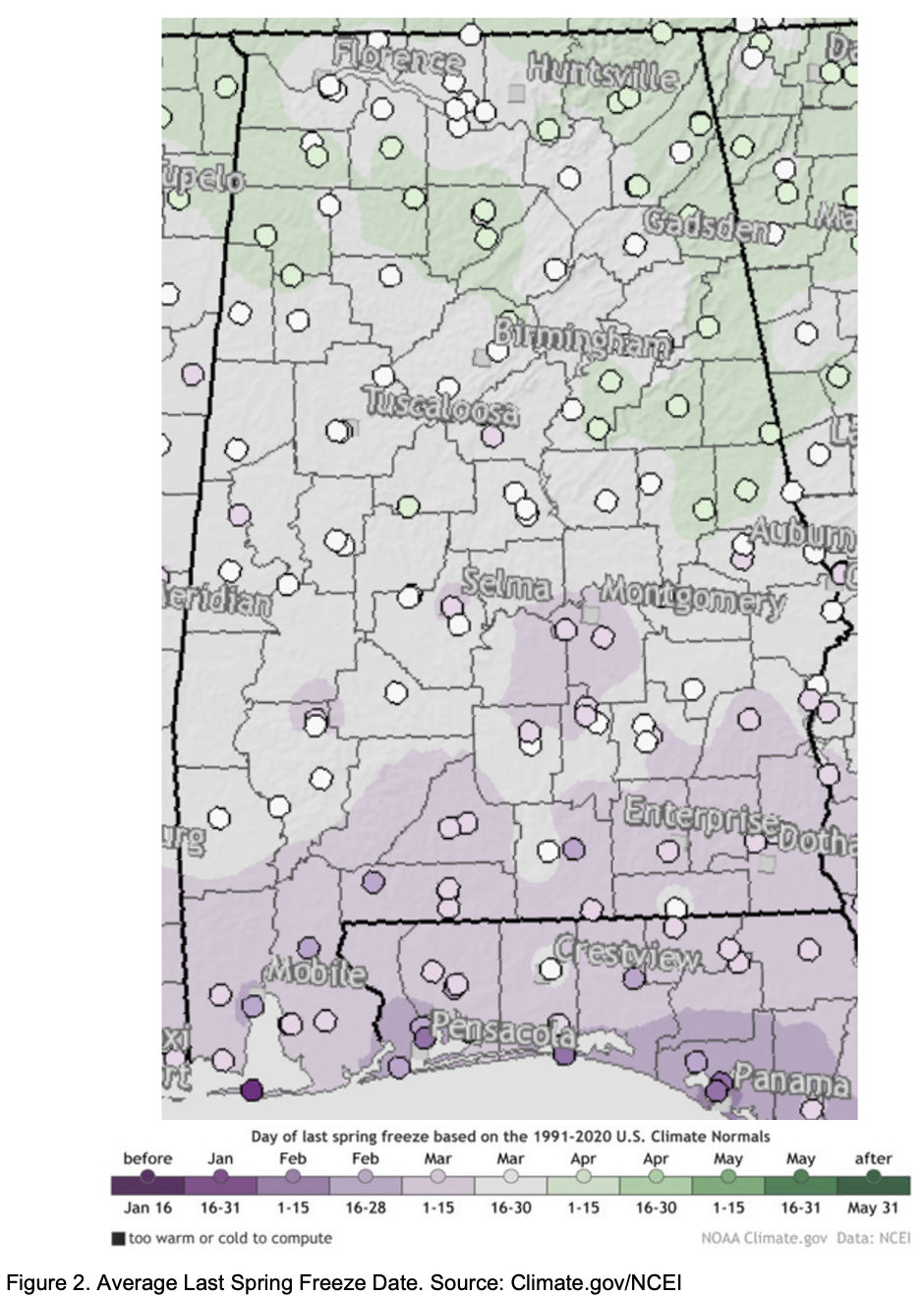
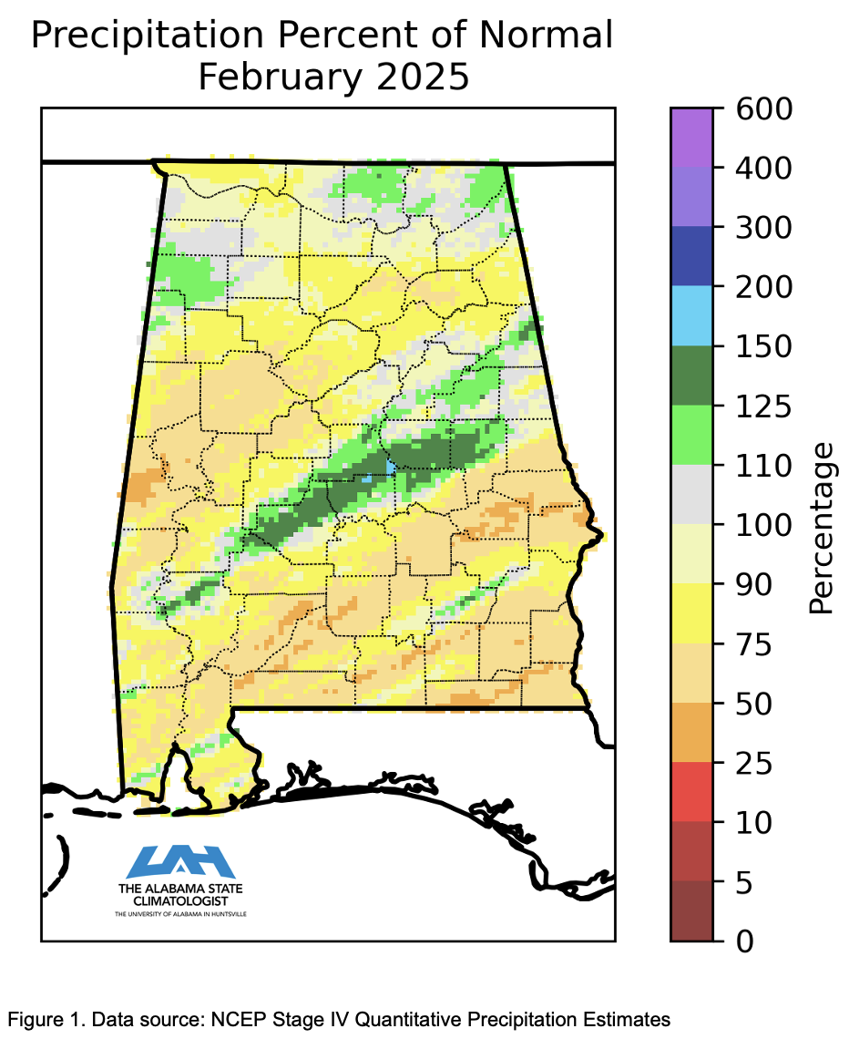
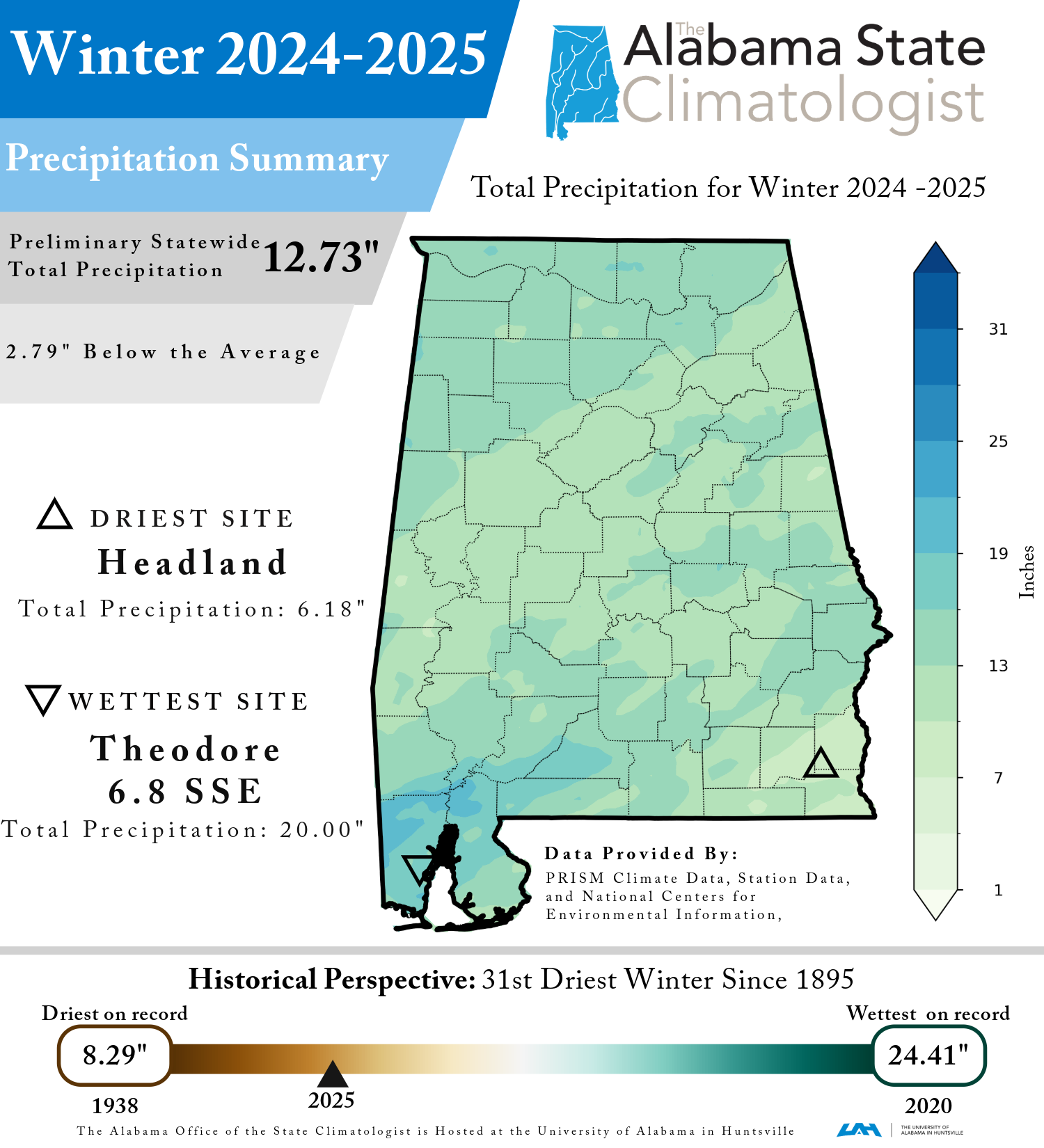
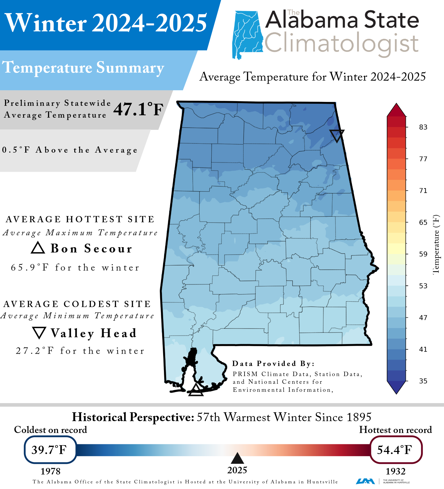
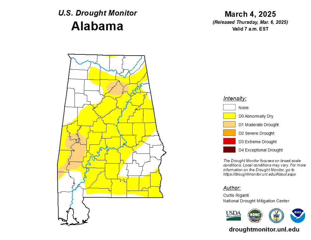
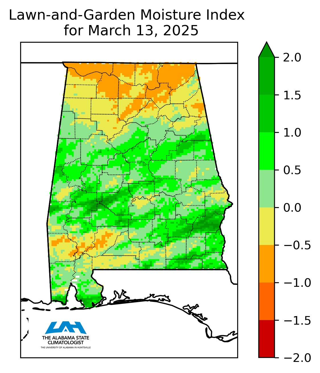
The drier than normal conditions have been a persistent theme this winter, and February continued that trend while also being unusually warm. Statewide, it was the 54th driest February on record, with 4.39 inches of precipitation, 0.79 inches drier than normal. The driest location of the month with no missing observations was the Andalusia-Opp Airport, which recorded only 2.02 inches of precipitation. However, some counties experienced wetter than normal conditions, thanks in part to a low-pressure system that moved across the state from February 11th through the 13th. From this system, a station in Alexander City recorded most precipitation for the month at 8.17 inches. Unlike, precipitation which varied between mostly dry and some wet counties, temperature was uniformly warmer than normal across the state. The statewide average temperature was 52.8°F, 4.8°F warmer than normal, making it the 19th warmest February on record. Most of Alabama experienced its warmest unseasonable temperatures during the first week and a half and the last few days of month, with many stations reporting daily average temperature departures of 15°F or more above normal. The warmest temperature recorded was 84°F at both the Andalusia-Opp Airport and Evergreen Middleton Field Airport on the 9th. In contrast, February also had a significant cold snap between the unseasonably warm periods, with many stations dipping into the teens. The coldest temperature of the month was 11°F, recorded at the Valley Head station on the 21st. Nearly two-thirds of Alabama was experiencing drought at the start of February, with 34% in moderate drought and 6% in severe drought. Conditions worsened over the first two weeks of February, with nearly 75% of the state facing drier-than-normal conditions by mid-month. A low-pressure system from February 11-13 brought up to 8 inches of rain to North and Central Alabama, easing severe drought and improving conditions statewide. By the end of February, severe drought had been eliminated, and most moderate drought conditions had eased. While much of the state remained abnormally dry, the storm provided significant relief, raising stock pond levels and restoring soil moisture, especially benefiting producers still recovering from the fall 2023 drought. February also brought the winter season to a close. By the end of winter, although much of the state remained abnormally dry, most drought conditions had been alleviated. With the conclusion of climatological winter (December, January, and February), let’s take a look at how Alabama fared this winter. Statewide, this winter was the 57th warmest winter on record, with an average temperature of 47.1°F, which is 0.5°F warmer than normal. In terms of precipitation, this winter was the 31st driest on record, with 12.73 inches of precipitation—2.79 inches drier than normal. Multiple snowfall events occurred across the state, including a historic Gulf Coast Snowstorm in January, detailed in last month’s ACR. The highest snowfall total for winter 2024-2025 was recorded by a CoCoRaHS observer at the Foley 2.8 NW station, measuring 10 inches from the aforementioned Gulf Coast Snowstorm. As winter comes to an end, many may be wondering when the last freeze on average occurs in Alabama. Given Alabama’s north-south orientation, the timing of the last freeze varies significantly across the state due to differences in latitude, elevation, and proximity to large bodies of water. Fortunately, NOAA has produced an interactive map (https://www.climate.gov/news-features/understanding-climate/interactive-map-average-date-last-spring-freeze-across-united) showing the average date of last spring freeze based on the 1991-2020 U.S. Climate Normals. Figure 2 provides a snapshot of this map for Alabama.
While these average dates serve as a general guideline, late-season cold snaps can still bring freezing temperatures beyond the average timeframe, especially in higher-elevation areas. It is important to monitor forecasts closely, especially if you plan to plant crops or flowers sensitive to freezing temperatures. March marks the beginning of climatological spring and the peak months of the severe weather season (March, April, and May) for Alabama. Thus, it is crucial to have a severe weather plan and to be prepared. Monthly summaries are provided by Dr. Rob Junod, Lee Ellenburg and Dr. John Christy.
|
CONTACT:
 |
Dr. JOHN R. CHRISTY Distinguished Professor, Atmospheric and Earth Sciences
Director, Earth System Science Center Alabama State Climatologist The University of Alabama in Huntsville 256-961-7763 christy@nsstc.uah.edu |
 |
Dr. ROB JUNOD Associate State Climatologist
Earth System Science Center The University of Alabama in Huntsville 256-961-7743 rjunod@nsstc.uah.edu |
 |
LEE ELLENBURG
Associate State Climatologist Alabama Office of State Climatology Earth System Science Center The University of Alabama in Huntsville 256-961-7498 wle00001@uah.edu |


