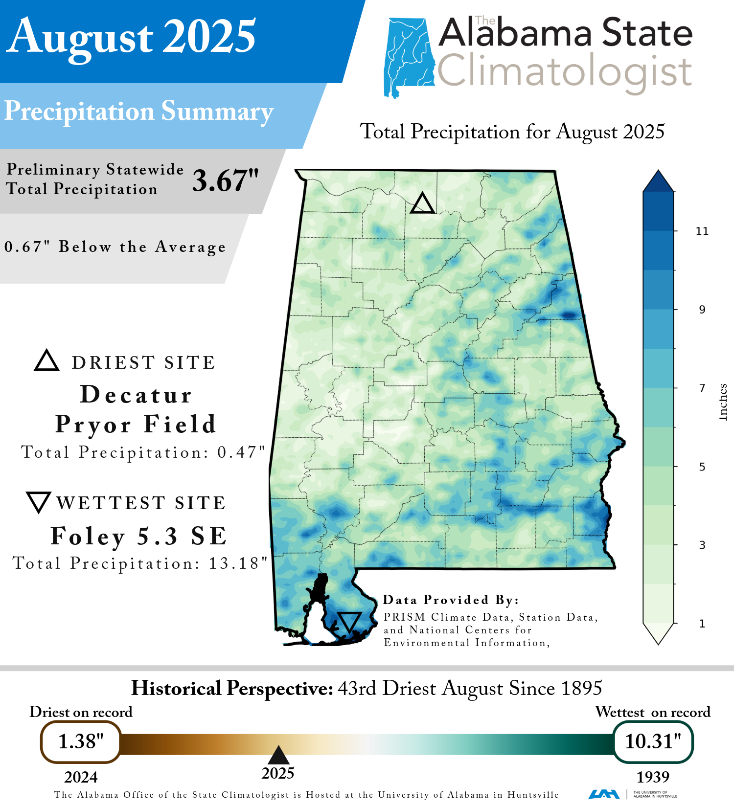
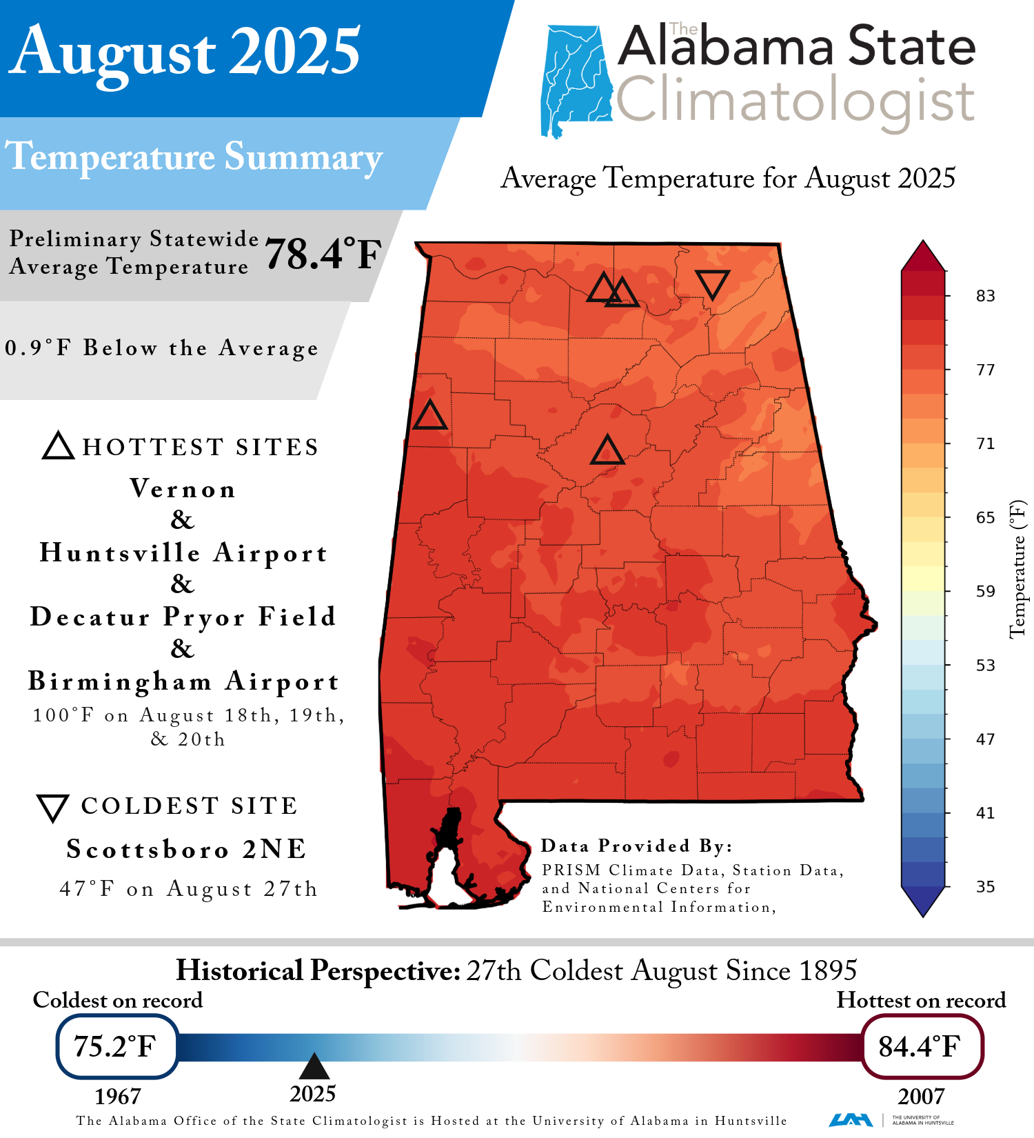
Following a very hot and humid July, this August was relatively cool for this time of the year. In fact, the average temperature was 0.9 cooler than the long-term average of 79.3°F, statewide. Rainfall was 0.67 inches less than the long-term average of 4.34 inches. There was, however, a significant disparity in rainfall between the western and eastern halves of Alabama.
August temperatures were relatively cool, particularly with regards to the daily maximum temperatures. Statewide, the average daily maximum temperature was 2.5°F cooler than the long-term average of 90.6°F. Eighteen stations set record lows for monthly average daily maximum temperatures for August. This included two long-observing stations—Valley Head and Oneonta—with records starting in 1893 and 1894 respectively. However, it is still August in Alabama. During a particularly hot spell from August 15th through the 21st, many stations recorded temperatures in the mid to upper 90s. Four stations recorded the month’s highest temperature of 100°F: Vernon (August 18th), Huntsville International Airport (August 18th), Decatur Pryor Field (August 19th), and Birmingham Airport (August 20th). By contrast, the coldest temperature in Alabama was recorded at the Scottsboro 2NE station at 47°F on the 27th.
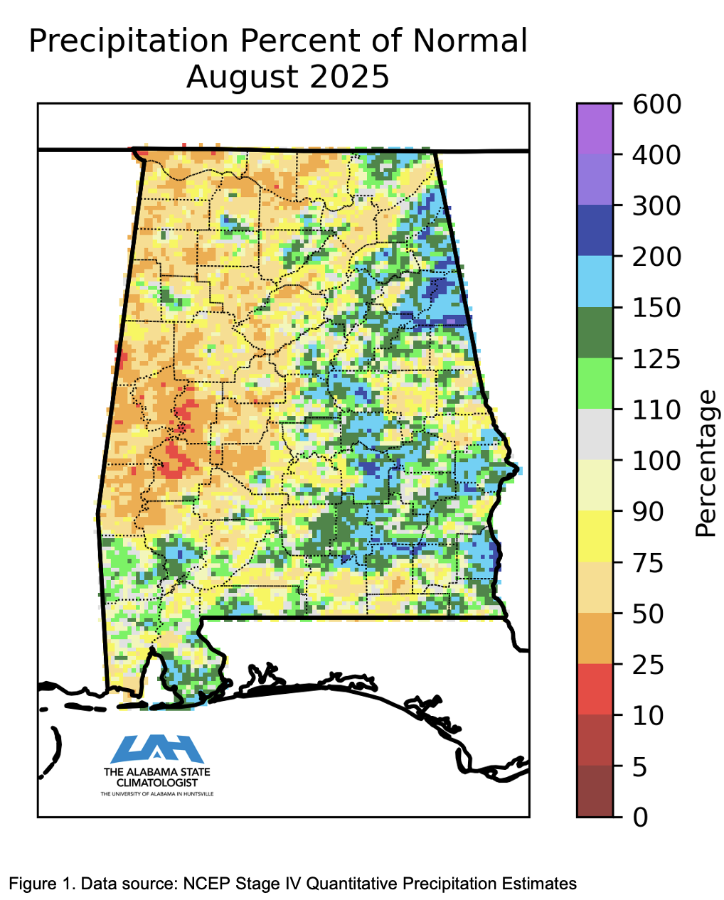
As stated in last month’s ACR, July had a variable rainfall pattern overall, August continued this variable pattern but with greater total rainfall amounts across the state. Most areas in the western half of the state received below normal rainfall, while most areas in the eastern half of the state and parts of the Gulf coast counties received above normal rainfall as shown in Figure 1. The wettest location of the month once again was in Baldwin County at the Foley 5.3 SE CoCoRaHS station with an impressive total of 13.18 inches of rainfall. On the dry side of the spectrum, the Decatur Pryor Field station recorded only 0.47 inches of rainfall, making it the driest location of the month with no missing days of observations.
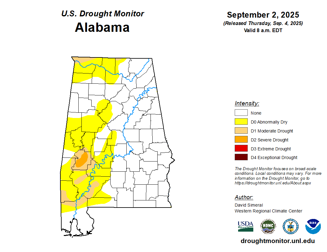
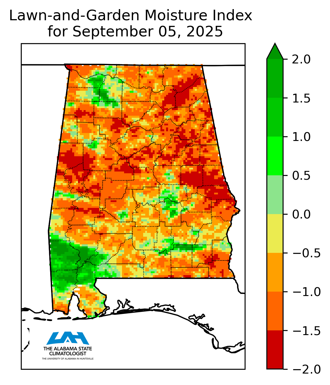
At the start of August, about one-third of Alabama was experiencing abnormal dryness, with pockets of moderate drought along the Georgia-Florida border and in Clarke County. Rainfall then varied widely across the state, bringing some improvement in the east but worsening conditions in the west. By mid-month, moderate drought had expanded across the southwest counties from South Dallas County to northern Mobile and Baldwin Counties, and it was also introduced in Jefferson County. Northwest counties also began to feel the effects of accumulating rainfall deficits as they fell into abnormal dryness. By the end of August, eastern Alabama had seen notable recovery, while central areas showed only slight improvement. However, drought conditions intensified in western counties, and by early September, moderate drought reached the Tennessee border and Marengo County deteriorated into severe drought.
These shifting conditions took a clear toll on agriculture. Prolonged dryness in some regions stressed both crops and livestock, with reports of dried pastures in Wilcox County, significant crop yield losses in Choctaw County, low pond water supplies in Sand Mountain, and late-planted crops struggling in northwest counties. Farmers across the Wiregrass region noted poor soil moisture and declining pasture quality. In contrast, eastern Alabama producers reported more favorable conditions, including healthier pastures, strong crop growth, and reduced reliance on irrigation. These local observations highlight the importance of drought impact reporting, which helps monitor conditions on the ground. Anyone can contribute to this effort by submitting Condition Monitoring Observer Reports (CMOR) online.
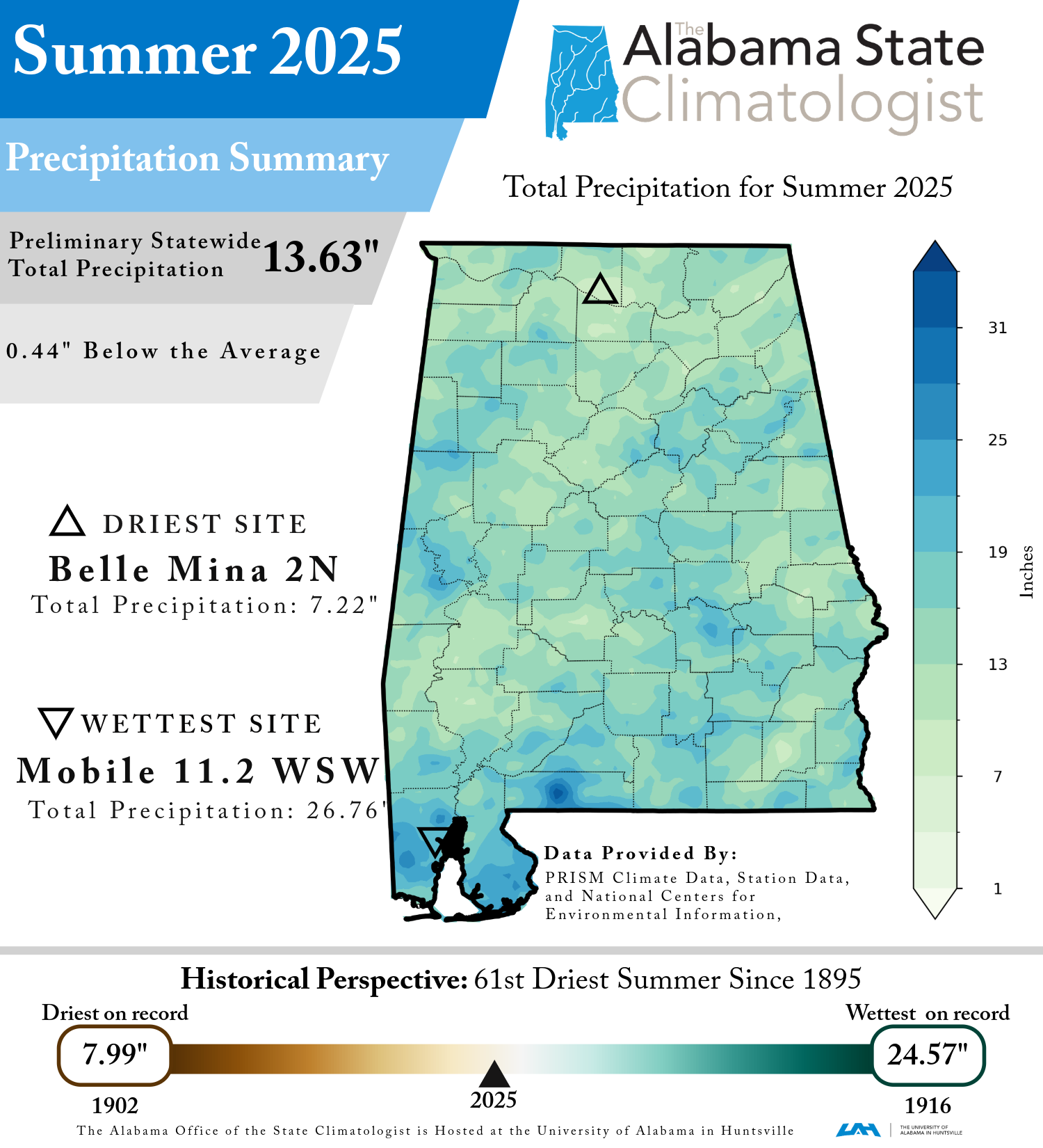
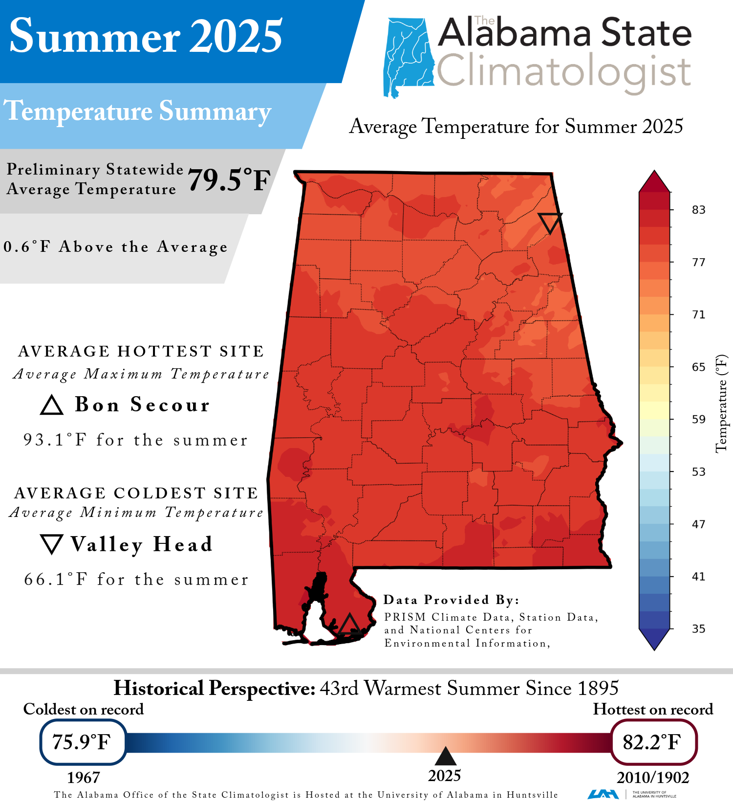
The end of August signals the end of climatological summer (June, July, August). How did the summer of 2025 stack up against other summers in Alabama?
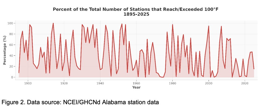
Statewide, the average temperature for the summer was 79.5°F, slightly warmer than normal by 0.6°F—the 43rd warmest on record. With regards to precipitation, this summer was 61st driest on record, with 13.63 inches of precipitation, which is 0.44 inches drier than normal. For those curious about hot summer temperatures, 17 stations reached or exceeded 100°F during summer 2025. While this might seem significant, it represents only about 15.5% of the 110 currently active reporting stations. This percentage is calculated by dividing the number of stations that reached or exceeded 100°F by the total number of active reporting stations for that specific year as shown in Figure 2. Using this methodology, the 15.5% for 2025 is much lower than the long-term average (1901-2000) of about 44.2%.
Monthly summaries are provided by Dr. Rob Junod, Lee Ellenburg and Dr. John Christy.
|


