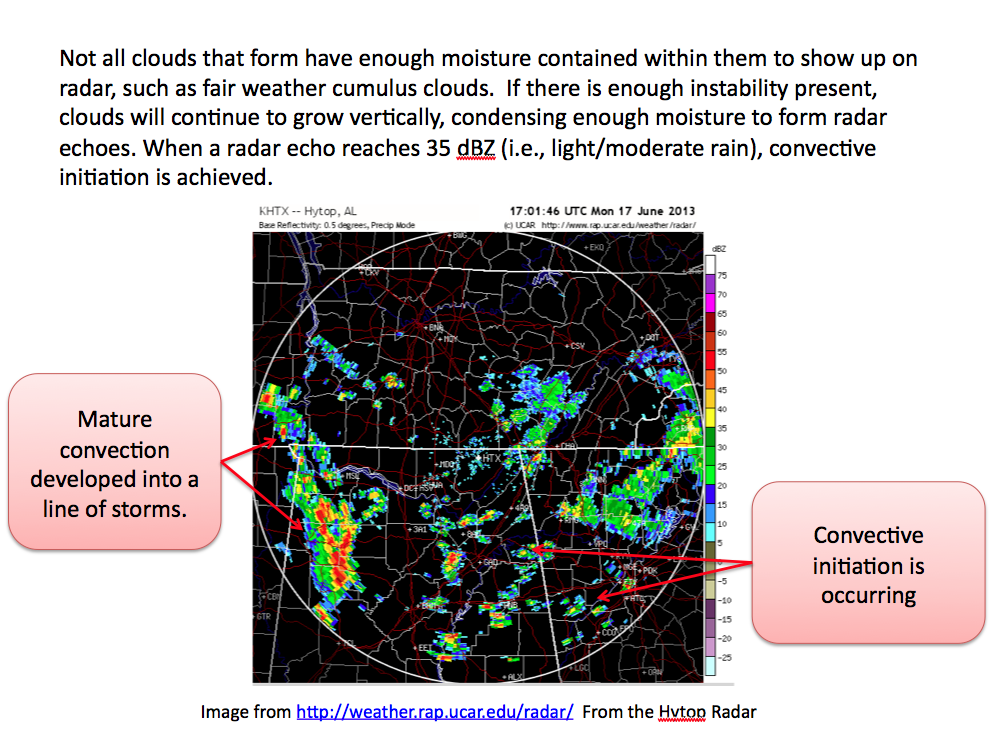
Not all clouds hold enough moisture to show up on radar; fair-weather cumulus clouds, for example, do not. If there is enough instability, clouds keep growing vertically, condensing enough moisture to form radar echoes. When a radar echo reaches 35 dBZ (light to moderate rain), convective initiation is achieved.
The radar image, from the Hytop, Alabama (KHTX) radar, shows mature convection that has developed into a line of storms, and new areas where convective initiation is occurring.
Radar image from the UCAR/RAP real-time weather data site.