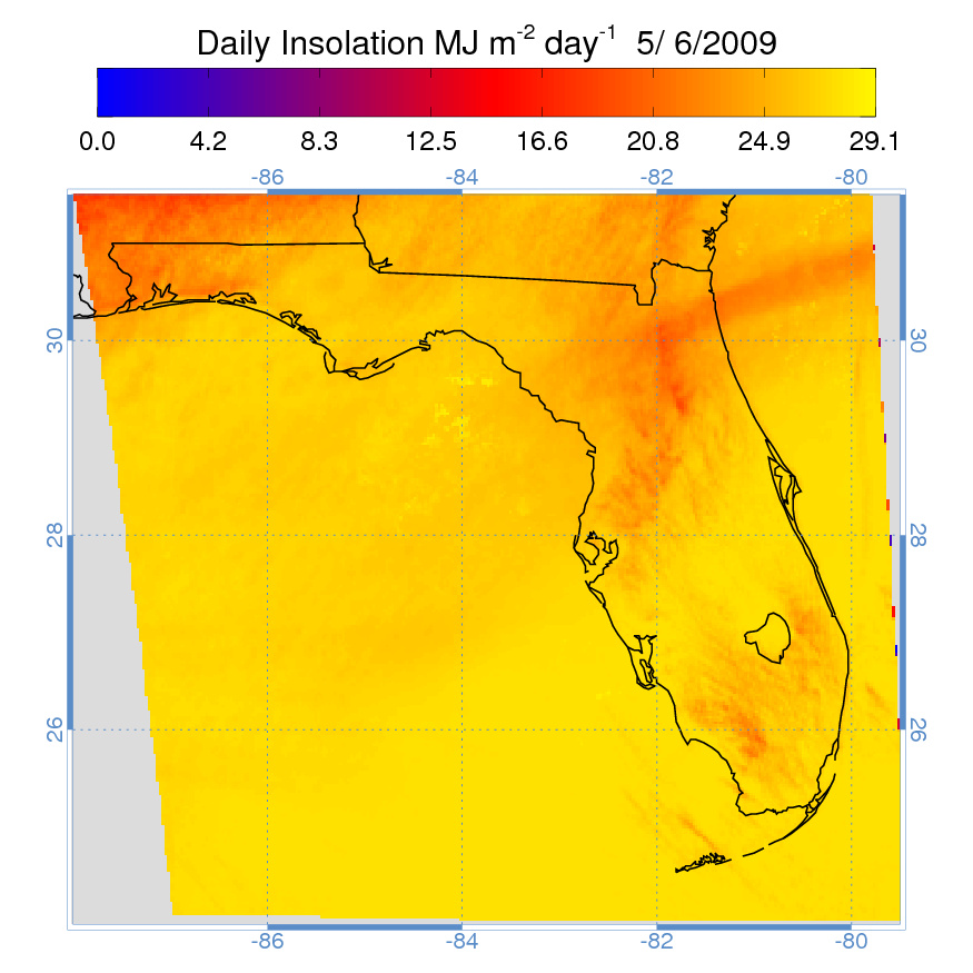
Estimates
of daily solar insolation from GOES-12 satellite data for the
state of Florida are being produced for use by the United States
Geological Survey (USGS) Florida Water Management Districts.
Solar insolation is a needed component in the estimation of potential
and reference evapotranspiration (PET and RET, respectively).
These are critical variables for water management, both in hydrologic
flow simulations and water allocation.
Because the network of ground-based instrumentation measuring solar
radiation in Florida is sparse, and additionally, because there
are variations in PET and RET calculation methodology used by the
five Florida Water Management Districts, the use of satellite-estimated
solar insolation will aid in the production of seamless and consistent
estimations of these parameters over the state of Florida.
To ensure data quality, validation of the algorithms used to process
the satellite-derived radiation data will be carried out using
actual (ground-based) solar radiation measurements.
|