IONS 06
Using the robust data set
collected during the INTEX Ozonesonde Network Study (IONS06) along
with total column ozone from the Total Ozone Mapping Spectrometer (TOMS)
on the Ozone Monitoring Instrument (OMI) and aerosol backscatter (532
and 1064μm) from the Cloud-Aerosol LIDAR Infrared Pathfinder Satellite
Observation (CALIPSO) and Aerosol Optical Depth from the Moderate Resolution
Imaging Spectroradiometer (MODIS), a high-pollution plume will be identified
on 20 August 2006. Backward and forward trajectories using the
Hybrid Single-Particle Lagrangian Integrated Trajectory (HYSPLIT) model
will be used along with L4 meteorological data and IR images from GOES-12
to determine the origin and general motion of the detected plume in
order to track the plume’s path. A general pattern will
be observed throughout the month of August of a region of relatively
low ozone over the Plains States and a region of relatively high ozone
over the Southeastern United States. Using ozone profiles collected
during IONS06 over the Eastern portion of the US and TOMS data a plume
of high tropospheric ozone was detected and the track this plume takes
will be identified.
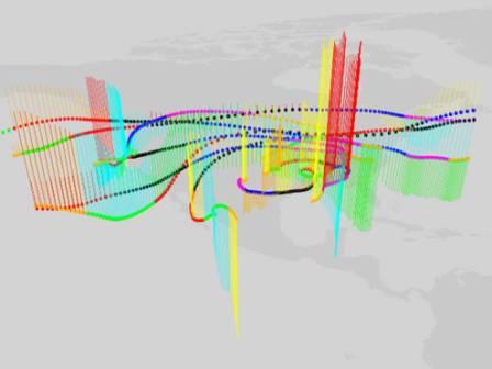
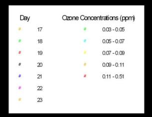
Fig R8. 3D Ozone trajectories,
17-23 Aug 2006. Vertical bars indicate altitude change per legend
colors. Date is indicated by color dot at 8.15km altitude layer.
|